010-C0763-10 Bluechart G2 HEU004RIrish Sea Data Card
Model: 010-C0763-10 Brand: Garmin
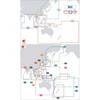
British coast: covers from Port Ellen on the Isle of Islay to Falmouth, including the Isle of Man and the Isles of Scilly. Irish coast: covers from Sheep Haven to Caherciveen, Republic of Ireland, including Londonderry, The Storks, Belfast, and Dublin. See your surroundings more clearly with BlueChart g2 data. With BlueChart g2, you'll get detailed marine cartography that provides convenient viewing of nautical content. BlueChart g2 allows you to see your vessel's precise, on-chart position in relation to naviads, coastal features, anchorages, obstructions, waterways, restricted areas and more. You will also have access to detailed mapping capabilities that include Safety Shading , Fishing Charts , smooth data transition between zoom levels, harmonious transition across chart borders, and reduction of chart discontinuities. « less
Product Specification
-
Universal Product Identifiers
Part Numbers: 010-C0763-10, 10804839, 35599GTIN: 00753759091491
Related Products
-
GPS receiver marine mount bracket
-
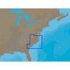
NA-C310 C-Card Format - Cape May - Winyah Bay
-
010-C0877-20 Bluechart G2 HXAE002RYellow Sea Microsd/sd Adaptor
-
Max Chart for New Zealand in SD Format, M-AU-M001
-
6000org-00-000 Merchant Mateiiflotation Vest Nylon Univ Org
-
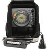
Ice 55 Flasher w/ 385ci Combo 39705
-
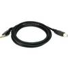
6ft USB 2.0 A Male to B Male 28/24AWG Cable - (Gold Plated)
-
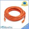
30ft 24AWG Cat6 550mhz UTP Ethernet Bare Copper Network Cable - Orange
-
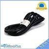
15ft 16AWG Power Cord Cable w/ 3 Conductor PC Power Connector Socket (C13/5-15P) - Black
-
230520 3 Way Connector 12-10
-
E55058 High SeaTalk Speed Network Switch
-
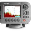
E62186-IN - A50D 5 Combo, Inland Maps, Int GPS