010-C0924-20 Bluechart G2 HXAW005RThe Gulf & Red Sea Microsd/sd
Model: 010-C0924-20 Brand: Garmin
HXAW005R Covers: Coverage of the Arabian Penninsula beginning at the Mediterranean Sea from Beirut to Alexandria. Coverage includes the Suez Canal, Gulf of Aqaba, and the Red Sea and Gulf of Aden in their entirety. Includes the Strait of Hormuz, Gulf of Oman, and coast of Somalia in the south. Coverage the of Kuwait, Saudi Arabia, Qatar, United Arab Emirates, along the southern coast of the Gulf and Iran along the northern coast. Coverage of Yemen and Oman coasts along the Indian Ocean to the Gulf of Oman, including Pakistan along the north coast, with general coverage of the Arabian Sea from Qamar Bay to the Delta of the Indus River. Included in this overall general coverage are numerous detailed charts covering areas such as Alexandria, Egy., Beirut, Leb., Al-Fuhaihil, Ad- Dammam, Bahrain, Ad-Dauha, and Abu Dhabi. Jiddah, Sau., Djibouti, Dji., and Aden, Yem. « less
Product Specification
-
Universal Product Identifiers
Part Numbers: 010-C0924-20, 10807154, 35798GTIN: 00753759093280
Related Products
-
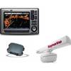
TP22 Tiller Autopilot ( Up to 36' and 11000Lbs) c16714
-
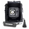
CH250BB/88/240 88 kHz Black Box Searchlight Sonar System. Includes 400mm Travel Hoist and Operates at 12VDC
-
E Series: E80/E120 Radar [DVD]
-
Radar 5012 Package with GMR24HD 4KW Radome & GSD22 Sounder
-
Package(E90W, GPS Antenna, DSM300G Sounder, RA1048D 4KW 48 Inch HD Digital Open Array Radar & 15m Radar Cable )
-
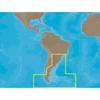
SA-C003 C-Card Format - Rio de Janeiro - Cape Horn
-
010-C0759-20 Bluechart G2 HXAW451SRed Sea Microsd/sd Adaptor
-
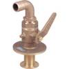
0834006PLB Seacock w/Curved TP 1in
-
Cat6a Ethernet Cable | 2ft | Gray | Network | 10 Gigabit
-
407870-1 Ice 345C
-
Serial cable - (DB-37) - M - (DB-37) - F - 6 ft - PC
-
CPA-138 Cell Phone Adapter Cable