010-C0752-10 Bluechart G2 HAF452SKnysna Sa to Beira MZ Data
Model: 010-C0752-10 Brand: Garmin
Coverage of the southeastern coast of Africa from Mossel Bay, S. Af. to the mouth of the Zambezi River. Detailed coverage includes Port Elizabeth and Durban, S. Af., Maputo, Moz., as well as the Prince Edward Islands. See your surroundings more clearly with BlueChart g2 data. With BlueChart g2, you'll get detailed marine cartography that provides convenient viewing of nautical content. BlueChart g2 allows you to see your vessel's precise, on-chart position in relation to naviads, coastal features, anchorages, obstructions, waterways, restricted areas and more. You will also have access to detailed mapping capabilities that include Safety Shading , Fishing Charts , smooth data transition between zoom levels, harmonious transition across chart borders, and reduction of chart discontinuities. « less
Product Specification
-
Universal Product Identifiers
Part Numbers: 010-C0752-10, 10804656, 35585GTIN: 00753759089733
Related Products
-
SP-70MT Autopilot for Cable Steer Tilt Type Helms st70mt
-
CF/674P+ Boston-ny Plat + on CF
-
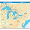
NT+ Wide Map, Lake Huron/Georgian Bay/North Channel NA-C104
-
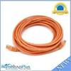
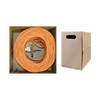
20ft 24AWG Cat5e 350MHz UTP Bare Copper Network Ethernet Cable - Orange
-
Bulk cable - CAT 6 - Unshielded twisted pair (UTP) 1000 ft - Orange
-
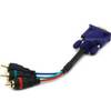
6025 6inch VGA to 3 RCA Component Video Cable (HD15 - 3-rca)
-
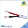
50ft 14AWG CL2 Rated 2-Conductor Loud Speaker Cable (for In-Wall Installation)
-
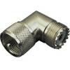
329955-1 UHF Right Angle Connector
-
210612 16-14 Mult. Stack .250 Tab 25P
-
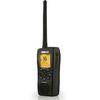
000-10217-001 - VHF-HH/GPS Combo, HH33U
-
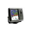
GPSMAP 545s - Marine GPS receiver - 5" color - 640 x 480
-
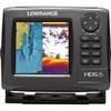
000-10516-001 HDS-5 Gen2 Lake Insight w/o Transducer