Garmin, Fishfinders/Chartplotters, Garmin
-
720s GPSMAP
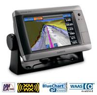
Garmin 720s GPSMAP is a stand-alone touchscreen chartplotter that brings a new level of functionality to your vessel. Featuring a brilliant 7-inch display, GPSMAP 720s puts all the information you need right at your fingertips. GPSMAP 720s is preloaded with a worldwide basemap and accepts additional map data for greater flexibility. In addition, GPSMAP 720s accepts radar input and offers full NMEA 2000 connectivity for greater convenience when adding extra sensors.
-
720 GPSMAP
Garmin 720 GPSMAP is a stand-alone touchscreen chartplotter that brings a new level of functionality to your vessel. Featuring a brilliant 7-inch display, GPSMAP 720 puts all the information you need right at your fingertips. GPSMAP 720 is preloaded with a worldwide basemap and accepts additional map data for greater flexibility. In addition, GPSMAP 720 accepts radar input and offers full NMEA 2000 connectivity for greater convenience when adding extra sensors.
-
740s GPSMAP
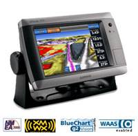
A Garmin 740s GPSMAP is a stand-alone touchscreen chartplotter that brings a new level of functionality to your vessel. Featuring a brilliant 7-inch display, GPSMAP 740s puts all the information you need right at your fingertips. GPSMAP 740s is preloaded with U.S. coastal maps. In addition, GPSMAP 740s accepts radar input and offers full NMEA 2000 connectivity for greater convenience when adding extra sensors.
-
740 GPSMAP
Garmin 740 GPSMAP is a stand-alone touchscreen chartplotter that brings a new level of functionality to your vessel. Featuring a brilliant 7-inch display, GPSMAP 740 puts all the information you need right at your fingertips. GPSMAP 740 is preloaded with U.S. coastal maps. In addition, GPSMAP 740 accepts radar input and offers full NMEA 2000 connectivity for greater convenience when adding extra sensors.
-
740s GPSMAP GMR 18 HD Radar Bundle
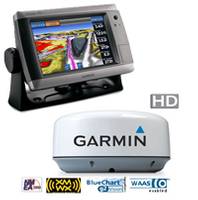
New Garmin 740s GPSMAP GMR 18 HD Radar Bundle is a stand-alone touchscreen chartplotter that brings a new level of functionality to your vessel. Featuring a brilliant 7-inch display, GPSMAP 740s puts all the information you need right at your fingertips. GPSMAP 740s is preloaded with U.S. coastal maps. In addition, GPSMAP 740s accepts radar input and offers full NMEA 2000 connectivity for greater convenience when adding extra sensors.
-
740s GPSMAP GMR 24 HD Radar Bundle
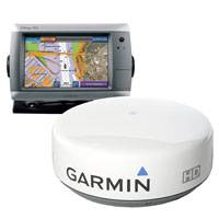
New Garmin 740s GPSMAP GMR 24 HD Radar Bundle is a stand-alone touchscreen chartplotter that brings a new level of functionality to your vessel. Featuring a brilliant 7-inch display, GPSMAP 740s puts all the information you need right at your fingertips. GPSMAP 740s is preloaded with U.S. coastal maps. In addition, GPSMAP 740s accepts radar input and offers full NMEA 2000 connectivity for greater convenience when adding extra sensors.
-
526/526s GPSMAP Chartplotter
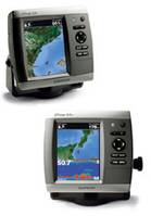
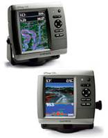
Garmin 526/526s GPSMAP is a compact chartplotter that features a high-resolution, super-bright 5” VGA display along with Garmin 526/526s improved high-speed digital design for increased map drawing and panning speeds. It’s ready to go with a built-in, satellite-enhanced worldwide basemap. The GPSMAP 526 also accepts BlueChart® g2 Vision cards for added features and functionality such as high-resolution satellite imagery, 3D views and Auto Guidance technology.
-
536/536s GPSMAP Chartplotter
Garmin 536/536s GPSMAP is a compact chartplotter that features a high-resolution, super-bright 5” VGA color display along with Garmin 536/536s improved high-speed digital design for increased map drawing and panning speeds. It’s ready to go with a built-in, satellite-enhanced basemap preloaded with U.S. Inland Lakes and an easy-to-use interface designed to help you navigate the open waters with ease. The GPSMAP 536 also accepts BlueChart® g2 Vision cards for added features and functionality such as high-resolution satellite imagery, 3D views and Auto Guidance technology.
-
546s GPSMAP Chartplotter with Transducer
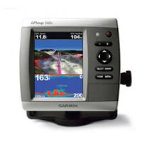
Garmin 546s GPSMAP with 50/200kHz Transducer is a compact chartplotter fishfinder that features a high-resolution, super-bright 5” VGA color display along with Garmin 546s improved high-speed digital design for increased map drawing and panning speeds. It’s ready to go with an easy-to-use interface and a built-in, satellite-enhanced basemap preloaded with all U.S. coastal areas, including Alaska and Hawaii as well as detailed charts for Bermuda. The GPSMAP 546s also accepts BlueChart g2 Vision cards for added features and functionality such as high-resolution satellite imagery, 3D views and Auto Guidance technology.
-
546s GPSMAP Chartplotter No Transducer
Garmin 546s GPSMAP is a compact chartplotter that features a high-resolution, super-bright 5” VGA color display along with Garmin 546/546s improved high-speed digital design for increased map drawing and panning speeds. It’s ready to go with an easy-to-use interface and a built-in, satellite-enhanced basemap preloaded with all U.S. coastal areas, including Alaska and Hawaii as well as detailed charts for Bermuda. The GPSMAP 546 also accepts BlueChart® g2 Vision cards for added features and functionality such as high-resolution satellite imagery, 3D views and Auto Guidance technology.
-
546 GPSMAP Chartplotter
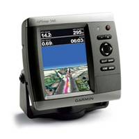
Garmin 546 GPSMAP is a compact chartplotter that features a high-resolution, super-bright 5” VGA color display along with Garmin 546/546s improved high-speed digital design for increased map drawing and panning speeds. It’s ready to go with an easy-to-use interface and a built-in, satellite-enhanced basemap preloaded with all U.S. coastal areas, including Alaska and Hawaii as well as detailed charts for Bermuda. The GPSMAP 546 also accepts BlueChart® g2 Vision cards for added features and functionality such as high-resolution satellite imagery, 3D views and Auto Guidance technology.
