Asset 1
News
All
Companies
Products
News
Advertise
News
Products
Companies
Home
Internal, Marine Navigation, Us Coastal, 0
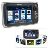
e7 Network Multifunction Display with U.S. Coastal Cartography
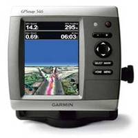
GPSMAP 546 Chartplotter
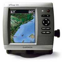
GPSMAP 526 Chartplotter
Refine Search
internal
(
x
)
•
marine navigation
(
x
)
•
us coastal
(
x
)
•
0
(
x
)
•
(1-3 of 3)
clear
Category
Chartplotters
(2)
Network Displays
(1)
Brand
Garmin
(2)
Raymarine
(1)
Accepts Data Cards
Yes
(3)
Antenna
Internal
(3)
Application
Marine Navigation
(3)
Battery Type
No Battery
(3)
Cartography
US Coastal
(3)
Dimensions
5.9"W x 6.4"H x 2.9"D
(2)
9.3"W x 5.8"H x 2.7"D
(1)
Display Resolution
640 x 480
(2)
800 x 480
(1)
Interface
NMEA 0183, NMEA 2000
(2)
NMEA 0183, NMEA 2000, WiFi, Bluetooth
(1)