Asset 1
News
All
Companies
Products
News
Advertise
News
Products
Companies
Home
External, 800 X 600, 0
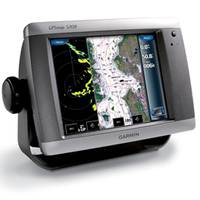
GPSMAP 5208 Network Chartplotter with U.S. Coastal Detail Maps, 8.4"
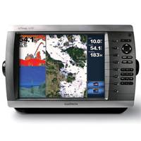
GPSMAP� 4210 Network Chartplotter with U.S. Coastal Detail Map, 10"
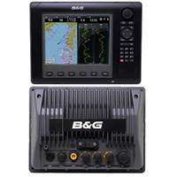
Zeus8 Multi-Function 8" Display
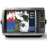
GPSMAP 4010 Network Chartplotter with Worldwide Basemap, 10" Diag. Screen
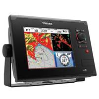
NSS8 Combo GPS with Sonar Multi-function Display
Refine Search
external
(
x
)
•
800 x 600
(
x
)
•
0
(
x
)
•
(1-5 of 5)
clear
Category
Network Displays
(4)
Network GPS & Sonar Combos
(1)
Brand
B&G
(1)
Garmin
(3)
Simrad
(1)
Accepts Data Cards
Yes
(4)
Not Stated
(1)
Antenna
External
(5)
Application
Marine Navigation
(5)
Battery Type
No Battery
(5)
Cartography
US Coastal
(3)
No Cartography
(1)
Worldwide Basemap
(1)
Dimensions
13.4"W x 8.9"H x 4.2"D
(2)
10.1W" x 6.8"H x 4.2"D
(1)
11.2"W x 8.3"H x 4.8"D
(1)
Not Stated
(1)
Display Resolution
800 x 600
(5)
Interface
NMEA 0183, NMEA 2000
(3)
Ethernet, NMEA 0183, NMEA 2000
(1)
SimNet, Ethernet, H-Link, NMEA 0183, NMEA 2000
(1)