Asset 1
News
All
Companies
Products
News
Advertise
News
Products
Companies
Home
Yes, 800 X 600, 0
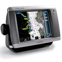
GPSMAP 5208 Network Chartplotter with U.S. Coastal Detail Maps, 8.4"
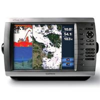
GPSMAP� 4210 Network Chartplotter with U.S. Coastal Detail Map, 10"
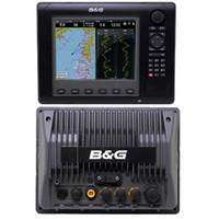
Zeus8 Multi-Function 8" Display
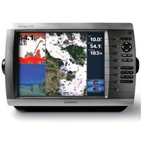
GPSMAP 4010 Network Chartplotter with Worldwide Basemap, 10" Diag. Screen
Refine Search
yes
(
x
)
•
800 x 600
(
x
)
•
0
(
x
)
•
(1-4 of 4)
clear
Category
Network Displays
(4)
Brand
B&G
(1)
Garmin
(3)
Accepts Data Cards
Yes
(4)
Antenna
External
(4)
Application
Marine Navigation
(4)
Battery Type
No Battery
(4)
Cartography
US Coastal
(3)
Worldwide Basemap
(1)
Dimensions
13.4"W x 8.9"H x 4.2"D
(2)
10.1W" x 6.8"H x 4.2"D
(1)
11.2"W x 8.3"H x 4.8"D
(1)
Display Resolution
800 x 600
(4)
Interface
NMEA 0183, NMEA 2000
(3)
SimNet, Ethernet, H-Link, NMEA 0183, NMEA 2000
(1)