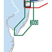
Waterproof Chart Kit - New Jersey Coast #WPB0360-02
Model: WPB0360-02 Brand: Maptech
Waterproof Charts w/ Companion CD WPB0360 360: New Jersey Coast New York Harbor to Cape May, NJ. 24 chart pages. Features GPS waypoints, Lat. /Long. grids, pre-plotted courses, ramps, and 425 marine facilities. 12 x 17, scales 1:1,263,000 to 1:15,000. Product Overview These easy-to-use, compact chart books are ideal for Day-Sailors, Fishing Boats, and Trailer Boats. They measure 12 x 17 (24 x 17 when open) and are made of waterproof, tear-resistant synthetic paper that will withstand the elements. GPS Ready New features make Waterproof Chartbooks easy to use with your GPS. Most charts include one-minute lat./long. grids to make vessel positioning a breeze, and major navigation aids are identified with named GPS waypoints. Small and Large-Scale Charts Waterproof Chartbooks include small-scale, wide area charts as well as large-scale, detailed charts of harbors and approaches. The Chart Page Index « less
Product Specification
-
Universal Product Identifiers
Part Number: WPB0360-02
Related Products
-
NAVPILOT 720 Autopilot for Inboard without Pumpset
-
5 Instrument Pod Un-Cut GP150
-
U1-200N-000 SE-200 BB Sonar w/o Ducer Includes VGA & Video
-
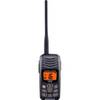
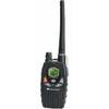
HX300 Handheld VHF Radio with USB Charger
-
Description of a New Improved Chart of the Islands of Shetland to Which Are Annexed Three Copper Plates and a Special Chart of Valey-Sound, Published from the Royal Danish Marine Archives for Draughts and Charts by P. de Lowenorn, 1787. [Book]
-
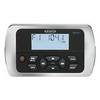
Marine Radio Nautico 1VP
-
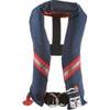
1230nav-00-000 Classic Seriesflotation Vest Nylon Univ Navy
-
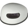
Innovative Lighting LED Deck Mount Navigation Light - White
-
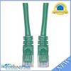
Cat6a Ethernet Cable | 1ft | Green | Network | 10 Gigabit
-
MWR150 Full Display Wired Marine Remote Control Map
-
DM-LTB-100 Light Bar for Dual Mounts
-
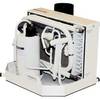
FCF-9000 Feel Cool Fast Marine Air Conditioner by Webasto