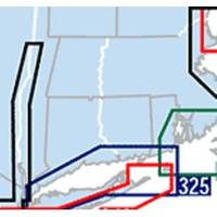
Waterproof Chart Kit - Long Island Sound #WPB0325-03
Model: WPB0325-03 Brand: Maptech
Waterproof Charts w/ Companion CD WPB0325 325: Long Island Sound NEW LAYOUT. 20 MORE PAGES. The entire Sound to Block Island and Point Judith. 10 overview charts and 50-plus harbor insets. 48 pages, 200 GPS waypoints, pre-plotted courses, ramps and 500 marinas. 12 x 17, scales 1:89,000 with insets. Product Overview These easy-to-use, compact chart books are ideal for Day-Sailors, Fishing Boats, and Trailer Boats. They measure 12 x 17 (24 x 17 when open) and are made of waterproof, tear-resistant synthetic paper that will withstand the elements. GPS Ready New features make Waterproof Chartbooks easy to use with your GPS. Most charts include one-minute lat./long. grids to make vessel positioning a breeze, and major navigation aids are identified with named GPS waypoints. Small and Large-Scale Charts Waterproof Chartbooks include small-scale, wide area charts as well as large-scale « less
Product Specification
-
Universal Product Identifiers
Part Number: WPB0325-03
Related Products
-
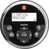
Marine Remote Control with LCD 10377778
-
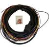
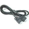
Boat (External) Wiring Harness Johnson/Evinrude OMC Black Plug New 473-9430 Instrument Cable Assembly
-
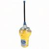
MCzmuro Smartfind Plus GPS 406 EPIRB Category 1 29954
-
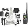
NT1VP Handheld Marine Band Radio mdlnt1vp
-
POD-4H 4 Person Lift Raft - Hard Canister
-
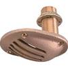
1" Intake Strainer
-
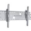
Adjustable Tilting Wall Mount Bracket for LCD LED Plasma (Max 165Lbs, 52~71inch) - Extra Wide - Silver
-
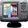
Elite 5 5" 83/200kHz Chartplotter/Fishfinder
-
DVI or VGA Interconnect Cable to (digital) 10M
-
6ft 28AWG DisplayPort Cable - White
-
10ft 22AWG 3-RCA Component Video Coaxial Cable (RG-59/U) - Black
-
Amber LED, 12 Volt DC, 8033