Understanding a Nautical Chart: A Practical Guide to Safe Navigation [Book]
A handy guide to making sense of a nautical chartWhether they are paper or electronic, charts are the most fundamental navigational tool. Making the best use of them requires a great understanding of symbols and abbreviations, as well as an awareness of the limits of accuracy in positions and soundings. Understanding a Nautical Chart not only helps you to read a chart, it allows you to understand that information and use it to navigate safely. Learning the abbreviations and symbols are critical to anybody using a chart and before you can use one, you must know them or at have easy access to the definitions, all of which are included in a full copy of the key to UKHO charts (Chart 5011).Explains how to establish the accuracy of charts to allow you to navigate with confidence and safety Written by a former Royal Navy Deputy Commander in Chief, Paul BoissierIncludes a full copy of the key to UKHO chart symbols (Chart 5011). The chart information included is presented in the following sections: General Chart Number, Title, Marginal Notes, Positions, Distances, Directions, Compass Topography Natural Features, Cultural Features, Landmarks, Ports, Topographic Terms HydrographyTides, Currents, Depths, Nature of the Seabed, Rocks, Wrecks, Obstructions, Offshore Installations, Tracks, Routes Areas, Limits, Hydrographic Terms Aids and ServicesLights, Buoys, Beacons, Fog Signals, Radar, Radio, Electronic Position-Fixing Systems, Services, Small Craft Facilities Alphabetical IndexIndex of Abbreviations, International Abbreviations, List of Descriptors, IALA Maritime Buoyage System Chart 5011 About the author: Paul Boissier has spent much of his professional life at sea and was a senior admiral in the Royal Navy. He is also a very experienced yachtsman and has cruised extensively. These perspectives make him the ideal author this guide. Paul is now the chief executive of the RNLI (Royal National Lifeboat Institution), the charity that saves lives at sea and operates over 340 lifeboats around the UK and the Republic of Ireland. « less
Product Specification
-
Authors: Paul BoissierPages: 200Format: paperbackPublication Date: June 21, 2011
-
Universal Product Identifiers
ISBN: 047074913XGTIN: 09780470749135
Related Products
-
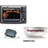
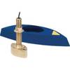
Package(E90W, GPS Antenna, DSM300G Sounder, 4KW 18 Inch Digital Radome & Radar Cable )
-
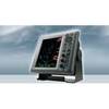
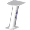
1945 10.4 Inch Color LCD 64 NM Radar with 6KW 48 Inch Open Array
-
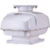
RSB0073-086 24/48 rpm Gearbox with 12 KW Transceiver (FR8122)
-
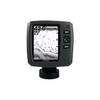
Fishfinder echo 200 - Fishfinder - included transducer - dual-beam
-
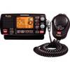
MR-F80B-D Rewind-Say-Again VHF Radio
-
50ft 24AWG Cat6 550mhz UTP Ethernet Bare Copper Network Cable - Orange
-
HBL61CM56 Adapter 50A 12V Female to 30A Male
-
B117-DO-2 600W Thru Hull Transducer Autohelm 2-Pin Connector
-
B45-DT-HB 600W Thru-Hull Transducer Humminbird #9 Connector
-
16 Inch Aft Power Mount Simrad Light Bracket Option PMA-16N-7L (PMA-167-M1 + ADA-R1)
-
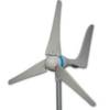
Products 45444 600 Watt Land Wind Turbine Power Generator wit
-
7ft 24AWG Cat6 550mhz UTP Ethernet Bare Copper Network Cable - Purple