The Sea Chart: The Illustrated History of Nautical Maps and Navigational Charts [Book]
Product Specification
-
Authors: John BlakePages: 160Format: paperbackPublication Date: July 1, 2009Key Terms: British Crown Copyright, portolan chart, rhumb lines, Admiralty, Pepys Library, Spice Islands, Australia, Royal Geographical Society, compass rose, Portuguese, Alexander Dalrymple, Cape Horn, Francis Beaufort, North America, James Cook, George Vancouver, Royal Navy, Samuel Wallis, Weddell Sea, Nootka Sound
-
Universal Product Identifiers
ISBN: 1844860639GTIN: 09781844860630
Related Products
-
SP110VF-4 SP-110 System w/Virtual Feedback & Type T Mechanical
-
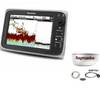
Package(c97 with USA Coastal Chart, 4KW 24 Inch Digital Radome & Radar Cable)
-
CH250BB/60/225 60 kHz Black Box Searchlight Sonar System. Includes 250mm Travel Hoist and Operates at 12VDC
-
T-941 4KW 36NM Radar 25" Radome 10M Cable
-
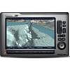
Package(E140W, GPS Antenna, DSM300G Sounder, 4KW 18 Inch Digital Radome & Radar Cable )
-
1-1 4 in. IPS Intake Strainer Bronze Made in The USA
-
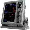
E120W Chartplotter U.S. Coastal Charts E62223-US
-
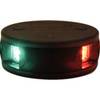
LED Bicolor Light Black 12V/24V ASL-341007
-
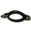
3ft 28AWG DVI-A to SVGA (HD15) Cable - Black
-
SmartPlug BF50 50 Amp Boatside Connector
-
pma24u8l 24 in. Power Mount Universal Domes
-
FUR-GP330B GPS Antenna/Receiver with 6 Meter Cable