Sea Charts of the British Isles: A Voyage of Discovery Around Britain & Ireland's Coastline [Book]
Sea Charts of the British Isles takes the reader on a voyage through the seaports, fishing and commercial harbors, naval bases and dockyards, and sea-side havens that have always supported local life in Britain and contributed to the Isles’ defense. This beautiful collection of charts contains a wealth of information about Britain’s maritime history, as well as the history of charting and surveying. The great names in British chart-making are all included, from Captain Greenvile Collins and Professor Murdoch Mackenzie to Graeme Spence and William Bligh. « less
Product Specification
-
Authors: John Blake, Lie, John Blake (Lieutenant Commander.)Pages: 128Format: hardbackPublication Date: November 19, 2005Key Terms: British Crown Copyright, Trinity House, Royal Navy, British Library, Scotland, British Isles, Admiralty, River Tyne, portolan charts, compass rose, Portland Bill, Pembrokeshire, South Ronaldsay, Isle of Wight, Lowestoft, River Thames, King's Lynn, Pentland Firth, Firth of Clyde, English Channel
-
Universal Product Identifiers
ISBN: 1844860248GTIN: 09781844860241
Related Products
-
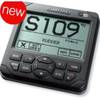
AP2402 Autopilot AP24,AC42,RC42,RF300 No Drive
-
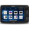
T70053 E127 Multifunction Display w/Sonar - European Charts
-
Package(c127 with aus, NZ, S. America, Asia Chart, 4KW 24 Inch Digital Radome & Radar Cable)
-
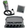
010-00756-00 VHF 300 Marine Radio
-
4430Mx4-00-000 4430 Inf PFD Sprtmn Chstpk MX4
-
Andr� Previn - Play Showboat [Digital Version]
-
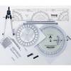
100 Marine Navigation Coast Guard Navigation Tool Kit
-
10ft USB 2.0 A Male to Micro 5pin Male 28/24AWG Cable w/ Ferrite Core (Gold Plated)
-
Marine -033420-10 Fuel CONN-FEMALE Mer (220050)
-
252150 Butt Connector #4 HD 2/pk
-
Fuel Line Connector Yamaha Female Fitting 2-Prong
-
GPSMAP421S Color Combo SOUNDER/GPS w/TM Transducer