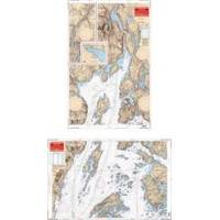
Rockport to Bangor, Maine Nautical Marine Charts - Waterproof Charts
Designed for recreational boaters, fishermen and divers. Waterproof Charts are beautifully printed on synthetic paper. For use on deck in any weather rain or spray! Accurate, used by Coast Guard and Navy, simple to use with GPS. Foldable and easy to hold and store Waterproof Charts are so tear resistant you can't ruin them. Printed on both sides so they save you money! This great chart combines 2 NOAA charts for coverage of this popular boating area. Starting in Bangor covers the Penobscot River downstream thru Bucksport to Searsport then broadens to cover Penobscot Bay, Belfast, Castine and Islesboro Island. An inset gives details of Belfast Harbor and east across the bay the coverage continues to Castine Harbor, Smith Cove and the Bagaduce River up to Northern Bay. Twenty two GPS waypoints make it easy to set up your GPS for navigating this area. Information from 2 NOAA charts 13309 and 13305. GPS datum. « less
Product Specification
-
Universal Product Identifiers
Part Number: 106
Related Products
-
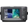
409000-1 858c HD Di Combo
-
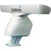
XN12A/4 4' Open Array Antenna
-
PowerTower 6 Alum Open Array Sitex Simrad Garmin APT6002
-
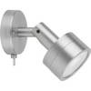
Marine ILIM4040 Hobart LED Reading Chart Marine Light
-
NA-M024 SD Card Format US West Coast and Haw
-
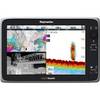
e165 15.4 Display Multifunction Inland Chart #E70025-IN
-
Marinenav Explorer Marine Navigation PC Computer EXP-013-AMD
-
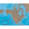
Canadian Charts - A, Alberni inlet/pt alberni/robbers Pa Canadian
-
UM415 VHF Fixed Radio 38460
-
SP36-1 Autopilot Rate Compass with No Drive
-
741 HPDB50 M/CN50 M SCSI Cable , 25pr - 6ft
-
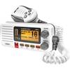
UM380 White VHF Radio Class D UM480