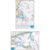
Paper Chart Kit Book REGION03 New York to Nantucket
Model: REGION03 Brand: Maptech
Completely updated. Coastal and offshore coverage. Full-color charts, GPS waypoints, courses and distances, Yeoman points, and color aerial photos. Save hundreds of dollars on charts. 22 X 17, 90 chart pages. Product Overview New features make ChartKits easy to use with your GPS. Most charts include one-minute lat./long. grids to make vessel positioning a breeze, and major navigation aids are identified with named GPS waypoints. GPS Ready New features make ChartKits easy to use with your GPS. Most charts include one-minute lat./long. grids to make vessel positioning a breeze, and major navigation aids are identified with named GPS waypoints. Small and Large Scale Charts ChartKits include small-scale, wide area charts as well as large-scale, detailed charts of harbors and approaches. « less
Product Specification
-
Universal Product Identifiers
Part Number: PAPREGION03
Related Products
-
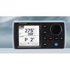
NAVPILOT 700OB Autopilot for Outboard without Pumpset
-
AP50 Full Function Second Station sap50nd
-
Massachusetts Fishing Chart Fish & Dive Nautical Marine Charts - Waterproof Charts
-
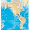
37673 Platinum Plus South Alaska on SD Micro SD
-
FBRS 2744 Battery Service Include 1098.1 Bat Parts Labor
-
1.5ft USB 2.0 A Male to A Female Extension 28/24AWG Cable (Gold Plated)
-
200-016 - 2*180 Degree Red - LED Navigation Light
-
100ft 16AWG CL2 Rated 4-Conductor Loud Speaker Cable (for
-
250ft 14AWG CL2 Rated 2-Conductor Loud Speaker Cable (for In-Wall Installation)
-
Marine Systems Inc AY665 Adapter - 6x6x5 ''Y''
-
Air Marine Tower Hardware Kit
-
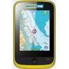
Memory-Map Adventurer 3500 GPS - Marine -Yellow/Black