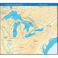
NT+ Wide Map, Mississippi and Illinois Rivers
Model: Brand: C-Map
C-MAP has set the standard for electronic charts with five consecutive NMEA awards for "Best Electronic Cartography". Built on the incredible success of C-MAP NT+, NT+ Wide combines a generation of chartplotters with efficient performance plus real-time accuracy and detail. Now you will be able to see slip detail as well as the locations for onshore facilities. « less
Product Specification
-
Universal Product Identifiers
Part Number: NA-C040GTIN: 00686074004016
Related Products
-
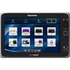
E70025 e165 15.4" Multifunction Display - Charts Not in
-
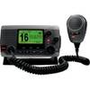
010-00754-00 - VHF 100, Basic, Grey
-
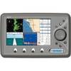
EC7EF Chartplotter w/External Antenna & Fishfinder Tan / Red
-
Classic Stern Light Black, Series 25 25500-7
-
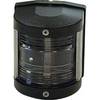
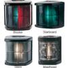
Marine Bi-Color Navigation Light
-
75ft 24AWG Cat6 550mhz UTP Ethernet Bare Copper Network Cable - Blue
-
6ft 28AWG HDMI to M1-D (pd) Cable - Black
-
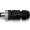
010-11094-00 NMEA 2000 Field Installable CONNECTOR, Male
-
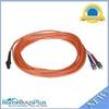
2640 Fiber Optic Patch cable,mtrj (m)/st,10m
-
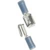
210612 16-14 Mult. Stack .250 Tab 25P
-
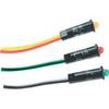
LED Red 11/64" 120VAC
-
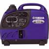
EF1000iS - 900 Watt Inverter Generator