NT+ Wide Chart (European Region & Middle East)
Model: Brand: C-Map
NT+ C-card technology is reverse-compatible with current NT charting systems. Full benefits of improved chart display are optimized on systems Designed for NT+ (or by updating your NT system software to NT+). Vastly Expanded Coverage: Important advances in technology now permit C-MAP to offer significantly increased coverage areas without sacrificing compatibility or performance with current C-card based navigating systems. This has, in turn, resulted in much more coverage at a much lower cost! Extra Information Not Found On Official Government Charts: True Color NavAids - Extensive NavAid information, allowing for on-screen display in true shapes and colors. Port Info - Complete and detailed databases of port facilities, services and contact information. Tide Info - NT+ C-cards include primary and secondary tidal stations that can be queried for easy access while navigating. Easy-to-read graphs display depth at high and low water for sun-up and sun-down. Tidal predictions make travel planning easier and safer. Improved Chart Display: Paper Chart Appearance - All the advantages of electronic charts with the familiar look of a paper chart. C-MAP's experience with professional navigation and highly effective chart display has resulted in a new chart look for NT+. This new look makes creative use of colors, patterns and icons to increase the familiarity and usability of the content-rich NT+ database. New NavAid Symbols and Styles - Depending upon navigation situations and mariner's preference, Aids to Navigation can now be configured for three basic styles: INTERNATIONAL - NavAids shown in real life shapes and colors for quick visual recognition (as per official paper chart presentations). UNITED STATES - NavAids shown in simplified shapes and real colors (as generally found on NOAA paper charts). SIMPLIFIED - NavAids shown in generic symbols for minimum visual clutter on-screen. SIMPLE - Some selections are turned off, such as Light Sectors, Seabed Type, Tracks & Routes, Lat/Lon Grid. FISHING - Turns off even more selections, like Tides & Currents, Ports & Services, Rivers & Lakes, Chart Boundaries. CUSTOM - The navigator selects which features he'd like on the screen. What are the Differences Between NT+ Local, Wide & SuperWide C-cards? Simply put, the differences lie in the C-cards geographical coverage and pricing. They differ only in the amount of the boating area that the individual NT+ C-card covers. « less
Product Specification
-
Universal Product Identifiers
Part Number: c11206euro
Related Products
-
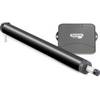
E12138 SmartPilot X-5 Tiller Grand Prix Corepack - Control H
-
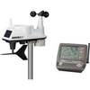
6250 Vantage Vue Wireless Weather Station
-
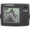
X135 Power - Pro Sonar 117-01
-
FR8062 12.1 Inch 6KW, 72 nm, 12.1 Color Display Radar 6' Open Array Antenna fr80626
-
Max Lakes West NA-M020 c30551
-
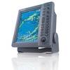
NSS12 Navigation Pack - NSS12, 3G Radar BSM-1
-
WPC046; Lii Egg Int NJ to Fnwk Isl de
-
2000007059 Auto/Manual One Size Inflatable Life Vest Jacket
-
Life Vest Foam Yellow Small
-
SP36-11 SP-36 Autopilot System
-
MARE-002 - Adapter, Yamaha Cmnd Link to Micro Fem
-
HDS-5x - Marine Chartplotter - 5" color - 480 x 480