NaM024 CCard Format u.s.west Coast and Hawaii
Model: NaM024 Brand: C-Map
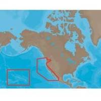
NA-M024 > USA West Coast and HawaiiCoverage of the Pacific Coast of the United States, including all of the coasts of California, Oregon and Washington. Coverage of Baja California and Mexico down to Puerto Vallarta. Detail of the Columbia River, Sacramento River, Willamette River. Snake River and San Joaquin Rivers are also included. Full coverage of Puget Sound and the San Juan Islands up to Point Roberts is also included. Additional coverage of the Hawaiian Islands out to Midway and Johnston Atoll is also included. « less
Product Specification
-
Universal Product Identifiers
Part Numbers: 30132, CMANAM024CCARD, NA-M024, NA-M024-C, NA-M024C-CARDGTIN: 000000165838, 00686074002753
Related Products
-
010-N0593-01 - GPSMAP 5208 Noh Chartplotter w/GPS Ant
-
CH270/324 180 kHz Searchlight Sonar System with 10.4 Inch Color LCD Display. Includes 350mm Travel Hoist and Operates at 24 and 32VDC
-
JMA-3340HS Radar 10KW 72 nm, 4 ft Open Array with 27-48 rpm Radar Antenna
-
Waterproof Chart Book - Casco Bay to Camden 35266
-
Fastfind 210 PLB w/ GPS, Flashing SOS Feature
-
Sospenders 1271 24G Manual Inflatable Vest - Blue
-
AP2402VRF Autopilot AP24,AC42,RC42 No Drive Unit
-
hi731352 Plastic Tip Set for 2000 L Graduated
-
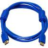
6ft 28AWG High Speed HDMI Cable w/Ferrite cores - Blue
-
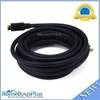
20ft 22AWG CL2 High Speed HDMI Cable - Black
-
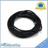
25ft 24AWG Cat6 550mhz UTP Ethernet Bare Copper Network 2316
-
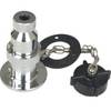
West Marine Electrical Connectors Four Pin