NA-M026 C-Card Format Great Lakes and The Maritimes
Model: NA-M026 Brand: C-Map
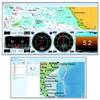
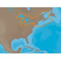
NA-M026 => Great Lakes, Northeast Coast and ApproachesCoverage of the Great Lakes, St. Lawrence River and Northeast United States. Coverage of the Great Lakes also includes Fox River and Lake Winnebago, Lake St. Clair, Rideau Canal, Ottawa River and the Trent-Severn Waterway. Includes all coastal charts for New Brunswick and Nova Scotia in Canada and Maine, New Hampshire, Massachusetts, Connecticut and New York in the U.S. Also included is coverage of the Hudson River and Lake Champlain as well as the Erie Barge Canal. Specifications:Port Plans: YesAerial Photos: Yes3-D View: Yes « less
Product Specification
-
Universal Product Identifiers
Part Numbers: 30127, NA-M026, NA-M026C-CARDGTIN: 000000165840, 00686074002791
Related Products
-
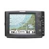
E12100-P - ST6002+ Flush Mount Contol Head
-
Chartplotter 330c, LMS-335cdf,480m,480mdf Sonar/Chartplotters [DVD]
-
Radar 4008 Package with GMR18 4KW Radome
-
EPIRB Programming Service for International Use Only
-
2897.91 FBRS 2897 Battery Replacement Service - PLB-30
-
FUGMAR-5 Marine 5 PC Navigation Software
-
617 6ft 28AWG Dual Link DVI-D to DFP (MDR20) Cable - Black
-
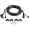
Split Connector 20ft Right Angle RJ45 Plug
-
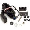
HST-DFSBL TM 50/200 Depth and Temp Blue Connector
-
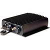
GDL 30 Series XM Marine Weather Satellite Receiver
-
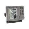
FishElite 480 - Marine Chartplotter - 5" monochrome - 480 x 480
-
1100 Series 1155c NVB - Marine Chartplotter - 10.4" color - 800 x 600