Max Mega Wide International cmegai
Model: Brand: C-Map
Dynamic tides and currents predict the time, level, direction and strength of currents and tides. Guardian Alarm performs an automatic forward-scanning check for obstacles. Use this feature as an added backup to alert you if you head toward a potentially harmful object. Photos and diagrams in high-definition of ports, marinas and significant navigational marks will help you to familiarize yourself with new destinations and passages. Route-check is an extension of Guardian Alarm, helping keep you safe by indicating obstacles along the segments between waypoints. Depths and land elevation show the usual depth information and the colors make it easy to distinguish different water depths and land elevations. Detailed harbor charts so docking in unfamiliar ports is no problem. You have precise layouts of thousands of marinas, including slip spaces, restricted areas and other valuable navigation information. Perspective view gives a bird's-eye view of your navigation area, it tilts the chart view to a 45-degree angle. C-Marina Port Database has details on more marinas than other charts on the market. Multi-language capability All C-MAP by Jeppesen charts can be displayed in both English and the local language of each region. « less
Product Specification
-
Universal Product Identifiers
Part Number: cmegai
Related Products
-
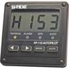
SP110 Autopilot
-
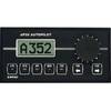
AP-35 Pack 2 Pilot AP35,J300X,RF300,RC25
-
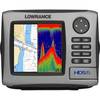
HDS-5 Lake Insight Multifunction w/o Trans 34242
-
Radar Mount, Edson Basic Fixed Flybridge Tower System for 8 to 16 Mile Radars
-
010-C0765-10 Bluechart G2 HEU006RScotland West Coast Data
-
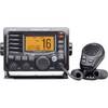
M504 Black VHF Radio with Hailer M504A 61
-
Marine Navigation and Safety of Sea Transportation [Book]
-
14ft 24AWG Cat6 550mhz UTP Ethernet Bare Copper Network Cable - Purple
-
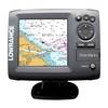
Elite 5M Chartplotter
-
15ft 24AWG CL2 Silver Plated High Speed HDMI Cable - Black
-
010-11095-00 NMEA 2K Female Connector
-
Inc ETS046717 Computer Hardware