MapSource BlueChart - Southwest Caribbean - Maps
Model: Brand: Garmin
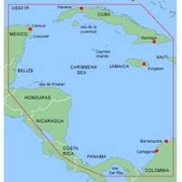
MapSource BlueChart is Garmin's exclusive marine cartography and was developed to provide you with mapping flexibility and options you've never had before. This line of cartography products is designed to provide interactive viewing of detailed nautical chart data, thereby providing navigators with innovative object-oriented cartography. These detailed electronic nautical charts look just like paper charts when displayed on your Garmin chartplotter. Features include shading between depth contours, spot soundings, navaids, port plans, wrecks, obstructions, inter-tidal zones, and more. BlueChart offers much larger coverage areas for half the price. MapSource BlueChart Southwest Caribbean provides detailed coverage of the northern coast of Central America from Cancun, Mexico to Barranquilla, Colombia, including the Panama Canal in its entirety and the general coverage of the northern half of the Gulf of Panama. It also includes detailed coverage of the coasts of Cuba, Jamaica, and the Caymans in their entirety. « less
Product Specification
-
General
Product Type: MapsDistribution Media: Garmin Data CardFirst Seen On Google Shopping: January 2006 -
Compatibility Information
Designed For: Garmin GPSMap 172C, 176, 176C, 178C, 178C Sounder, 182, 182C, 188 Sounder, 188C Sounder, 196, 2006, 2006C, 2010, 2010C, 2106C, 2110C, 2206C, 2210C, 232, 238 Sounder, 276C, 292C, 296, 298C, 3006C, 3010c, 3205C, 3206C, 3210C, 376C, 392C, 396C, 492C, 498C -
Universal Product Identifiers
Part Numbers: 010-C0045-00, Southwest CaribbeanGTIN: 00753759040116, 00923848717209
Related Products
-
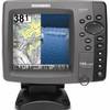
788ci HD Di Combo Down Imaging Combo 39704
-
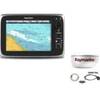
CH250BB/60/240 60 kHz Black Box Searchlight Sonar System. Includes 400mm Travel Hoist and Operates at 12VDC
-
DRS12A - Digital Radar 12KW 72NM No-Ant 15m Cable
-
Package(c95 with USA Coastal Chart, 4KW 24 Inch Digital Radome & Radar Cable)
-
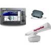
Package(C120W, DSM300G Sounder, RA1048D 4KW 48 Inch HD Digital Open Array Radar & 15m Radar Cable)
-
Marine World Chart of Nicolo De Canerio Januensis 1502: A Critical Study [Book]
-
BlueChart g2 Vision - South Maine - Maps
-
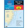
Waterproof Chart Kit - New Jersey Coast 35271
-
AP50 02 Autopilot System - AP50 2 Autopilot
-
20ft 24AWG Cat6 550mhz UTP Ethernet Bare Copper Network Cable - Yellow
-
Ethernet Over Power Adapter (Pair) - 200Mbps
-
ME-AGS-N - Automatic Gen Start Module, Network