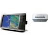
MapSource BlueChart - New York - New Jersey - Maps
Model: Brand: Garmin
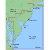
MapSource BlueChart is Garmin's exclusive marine cartography and was developed to provide you with mapping flexibility and options you've never had before. This line of cartography products is designed to provide interactive viewing of detailed nautical chart data, thereby providing navigators with innovative object-oriented cartography. These detailed electronic nautical charts look just like paper charts when displayed on your Garmin chartplotter. Features include shading between depth contours, spot soundings, navaids, port plans, wrecks, obstructions, inter-tidal zones, and more. BlueChart offers much larger coverage areas for half the price. MapSource BlueChart New York - New Jersey offers coverage of Raritan Bay to Norfolk, includes Tarrytown to Fire Island Inlet, entire New Jersey coastline, Delaware Bay, Delaware River, C&D Canal, Chincoteague Bay and Newport News. « less
Product Specification
-
General
Product Type: MapsDistribution Media: microSD Memory CardFirst Seen On Google Shopping: January 2006 -
Compatibility Information
Designed For: Garmin eTrex Legend Cx, Vista Cx Garmin GPSMAP 60CSx, 60Cx, 76CSx, 76Cx -
Universal Product Identifiers
Part Numbers: 010-C0340-00, New York - New JerseyGTIN: 00753759055691
Related Products
-
AP35-3 Autopilot with AP35, J300X-40(20A peak), Rudder Feedback RF300 sap35-3
-
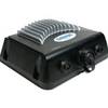
GSD 22 Digital Sonar (322-0100039700)
-
Radar 4010 Package with GMR18 4KW Radome
-
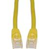
Cat6a Ethernet Cable | 7ft | Yellow | Network | 10 Gigabit
-
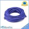
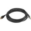
75ft 24AWG Cat5e 350MHz UTP Bare Copper Ethernet Network Cable - Purple
-
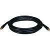
15ft USB 2.0 A Male to A Male 28/24AWG Cable (Gold Plated)
-
10ft RG6 (18AWG) 75OHM, Quad Shield, CL2 Coaxial Cable with F Type Connector - Black
-
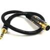
1.5ft Premier Series XLR Female to 1/4inch TRS Male 16AWG
-
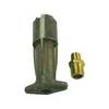
18-8082 1/4 in. NPT Fuel Tank Connector
-
18-8804-1 Premium Marine Spark Plug Wire Leads
-
P30 30 Amp Cover Plate for Receptacle (Gray)
-
Lumishore THX72-B Thru-Hull Underwater Light - Blue 72w