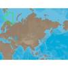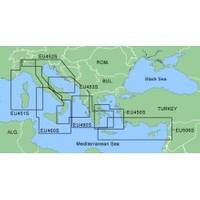
MapSource BlueChart - Adriatic Sea, South Coast - Maps
Model: Brand: Garmin
MapSource BlueChart is Garmin's exclusive marine cartography and was developed to provide you with mapping flexibility and options you've never had before. This line of cartography products is designed to provide interactive viewing of detailed nautical chart data, thereby providing navigators with innovative object-oriented cartography. These detailed electronic nautical charts look just like paper charts when displayed on your Garmin chartplotter. Features include shading between depth contours, spot soundings, navaids, port plans, wrecks, obstructions, inter-tidal zones, and more. BlueChart offers much larger coverage areas for half the price. MapSource BlueChart Adriatic Sea, South Coast provides detailed coverage of Italian coast from Porto Civitanova to extend south to Siracusa, Sicilia. From Split, Croatia to Killini, Greece. « less
Product Specification
-
General
Product Type: MapsDistribution Media: microSD Memory CardFirst Seen On Google Shopping: January 2006 -
Compatibility Information
Designed For: Garmin eTrex Legend Cx, Vista Cx Garmin GPSMAP 60CSx, 60Cx, 76CSx, 76Cx -
Universal Product Identifiers
Part Numbers: 010-C0440-00, Adriatic Sea, South Coast
Related Products
-
Package(c97 with USA Coastal Chart, 4KW 18 Inch Digital Radome & Radar Cable)
-
RDP149NT 10.4 Color LCD Waterproof Display C-Map NT
-
RS-C208 Furuno FP Format - Barents Sea West Fishing
-
AP2804VRF Autopilot AP28,AC42,RC42,RPU160 32222
-
hi731352 Plastic Tip Set for 2000 L Graduated
-
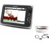
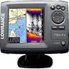
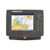
Elite 5 Gold Combo Fishfinder/Chartplotter
-
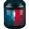
Navigation Light for Bulk Head mounting, Port
-
25ft VGA to 3 RCA Component Video Cable (HD15 - 3-rca)
-
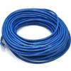
100ft 24AWG Cat6 550mhz UTP Ethernet Bare Copper Network Cable - Blue
-
/ Quicksilver 22-808727 Trim Hose Connector W/Screen
-
75' Network Cable for Scp Remote Panel 809-0942
-
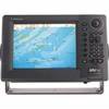
GlobalMap 7300C HD - Marine GPS receiver - 7" color - 640 x 480