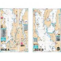
Lake Champlain Fishing South - Waterproof Charts
Designed for recreational boaters, fishermen and divers. Waterproof Charts are beautifully printed on synthetic paper. For use on deck in any weather rain or spray! Accurate, used by Coast Guard and Navy, simple to use with GPS. Foldable and easy to hold and store Waterproof Charts are so tear resistant you can't ruin them. Printed on both sides so they save you money! All Charts are 25"x38" This LARGE PRINT Lake Chart details all of the Major Fishing Areas and pinpoints dozens of specific areas for the major species caught in the area. (Large and Smallmouth Bass, Yellow Perch, Walleye, Muskie, Northern Pike, Salmon & Trout). Many areas have GPS positions. Grass and Marsh areas are also identified. Marinas are listed as well as popular Boat Ramps. From the south, side "A" starts at Whitehall N.Y. and continues north to Burlington Vt. The reverse side continues north from Willsboro Point and Shelburne Bay to Cumberland Head and Savage Island. Information from 3 NOAA Charts; 14782, 14783, 14784. Chart is 25" X 38" and is folded to 7" X 14" « less
Product Specification
-
Universal Product Identifiers
Part Number: 11F
Related Products
-
000-10871-001 HDS-10 Gen2 Insight USA w/LSS-2, 83/200 kHz & L
-
LMP-2 F/ Sitex Simrad et Al Domes
-
Radar 5208 Package with GMR24HD 4KW Radome & GSD22 Sounder
-
PiranhaMAX 160 - Fishfinder - portable - included transducer : XPT-9-20-T - dual-beam
-
T70040 E95 Multifunction Display w/US Coastal Charts
-
NT+ Wide Chart (americas) c11206
-
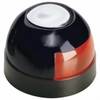
Series 22 Navigation Lights Deck Mount, Red, 1/4" x 1/8"
-
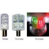
Navigation Light BAY15d Replacement Bulb 9353392
-
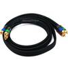
6ft 18AWG CL2 Premium 3-RCA Component Video Coaxial Cable
-
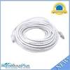
50ft 24AWG Cat5e 350MHz UTP Bare Copper Ethernet Network Cable - White
-
24006199 - Adapter, Simnet to N2K Micro-C (Female)
-
Lumishore THX72-CCP-FF-2 Thru-Hull Flush Fit Color Change Underwater L