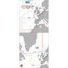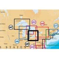
Inc MSD/649P Map, Lake Erie & Saint Clair
Model: 649P Brand: Navionics
Navionics 649P+ Lake Ontario Platinum+ Multi-Dimensional Charts, with the most advanced technology and best imaging available, provide high-resolution photo/chart overlay, full-view XGA panoramic pictures, improved 3D view, complete geo-referenced coast pilots. Compatibility Guide
Product Specification
-
Universal Product Identifiers
Part Numbers: 11093846, 37652, 649P+, DEF-257881MSD649, MSD-649P-, MSD649P+, SD649P, SD/649P+GTIN: '82124564959, 00821245649591
Related Products
-
Radar 5015 Package with GMR24HD 4KW Radome & GSD22 Sounder
-
BlueChart g2 Vision - Italy, Adriatic Sea - Maps
-
Max EW-M225 W15 France Inland-MAX
-
Elements of Navigation; Chart, Lead, and Log: Deviation and Compass Compensation; Piloting; Dead Reckoning; Nautical Tables (1909) [Book]
-
FBRS 2744 Battery Service Include 1098.1 Bat Parts Labor
-
LJ-XXL - Adult Life Vest Size XXL
-
1551 Rigging Knife Deluxe
-
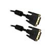
6.6 ft DVI cable - dual link 24 pin digital DVI - male - PC
-
1.25" Intake Strainer
-
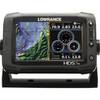
HDS-7M Gen2 Touch Insight Chartplotter
-
Video cable - Male 19 pin HDMI Type A to M 18 pin digital DVI (Single-Link)
-
Fiber Optic Cable, LC/LC, Multi Mode, Duplex - 1 Meter 6202