How To Read a Nautical Chart: A Captain's Quick Guide [Book]
Your quick-reference, on-board guide to the symbology and shorthand notations used on nautical charts Nautical charts contain an incredible amount of information for those who know how to decipher them. But without a key to the symbology, a chart can be bewildering. Nigel Calder, one of today's most respected boating authors, helps you make sense complex system of signs, symbols, and graphic elements with this compact, waterproof, and nearly indestructible guide. « less
Product Specification
-
Authors: Nigel CalderPages: 16Format: paperbackPublication Date: November 11, 2008Key Terms: nautical chart, Chesapeake Bay, cardinal marks, navaids, nautical mile, Penobscot Bay, true north, day beacon, swing bridge, vector chart, NOAA chart, electronic charts, Hydrographic Office, lighthouse, magnetic north, raster chart, Kelp, spring tides, Occulting, paper charts
-
Universal Product Identifiers
ISBN: 0071592873GTIN: 09780071592871
Related Products
-
hi731340 200 L Graduated Pipette
-
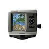
HDS-7 Gen2 Fishfinder GPS Chartplotter 53519700
-
Fishfinder 90 - Fishfinder - included transducer - dual-beam
-
MapSource BlueChart - Anchorage to Juneau - Maps
-
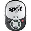
Spot 2 Satellite GPS Messenger - Silver Gloss Silver
-
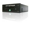
Marinenav Explorer Marine Navigation PC Computer EXP-013-intel
-
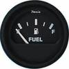
2" Euro Black Series Fuel Level Gauge
-
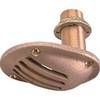
1.25" Intake Strainer
-
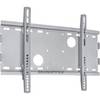
Low Profile Wall Mount Bracket for LCD LED Plasma (Max 165Lbs, 23~37inch) - Silver
-
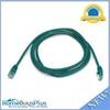
7ft 24AWG Cat5e 350MHz UTP Bare Copper Ethernet Network Cable - Green
-
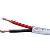
50ft 12AWG CL2 Rated 2-Conductor Loud Speaker Cable (for In-Wall Installation)
-
GPSMAP 420s - Marine GPS receiver - 4" color - 240 x 320