Chart No. 1 Nautical Chart Symbols Abbreviations and Terms [Book]
Chart No. 1 contains a description of the symbols, abbreviations and terms that appear on nautical charts produced by the National Imagery and Mapping Agency, the National Ocean Service and the International Hydrographic Organization.
Product Specification
-
Authors: Griffes, NIMAFormat: paperbackPublication Date: January 1, 2000Key Terms: Plane of Reference, Sector lights, Traffic separation scheme, chart datum, buoy, nautical miles, Racon, Anchorage, Degaussing, nautical charts, World Geodetic System, Fish haven, WHlS, Ash Volcanic, Dot Lt, Supplementary national symbols, Cable Ferry, Loran-C, Submarine power cable, Topmark
-
Universal Product Identifiers
ISBN: 1577852753GTIN: 09781577852759
Related Products
-
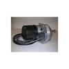
Dashboard Autopilot Drives for Cable Steering 12V 29010002
-
T-940-3 4KW 3.5' Open Array Radar
-
Max EM-M111 W20 East Mediterranean-MAX
-
VCA014R Nunavut & Hudson Bay Bluechart G2 Vision 35806
-
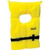
Life Vest Foam Yellow Medium
-
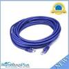
20ft 24AWG Cat5e 350MHz UTP Bare Copper Ethernet Network Cable - Purple
-
2797 91 FBRS 2897 Battery
-
CANNON 720076-1 as DPS Y Serial Port Splitter Cable
-
Ethernet Over Power Adapter (Pair) - 200Mbps
-
HST-WSBL TM Ducer Depth/Temp Blue Connector
-
Amber LED, 12 Volt DC, 8033
-
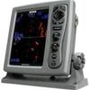
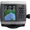
GPSMAP 421 - Marine Chartplotter - 4" color - 240 x 320