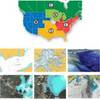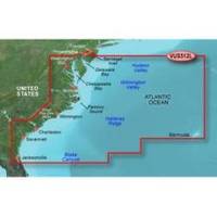
BlueChart g2 Vision - Mid-Atlantic - Maps
Model: Brand: Garmin
BlueChart g2 Vision offers the same rich detailed charting of BlueChart g2 to help you get the most out of your unit. In addition, g2 Vision features a growing database of high-resolution satellite imagery, above and below the water 3D perspective, auto guidance technology, aerial photographs for real world reference and coastal roads with points of interest. This product features coverage of the East Coast from the lower Chesapeake Bay through Jacksonville, FL, to Bermuda. Coverage from Tangier Island to St. Augustine, FL including Norfolk, VA, the Albemarle and Pamlico Sounds in full, Cape Fear, NC, the Savannah R. to Augusta, GA, and the St. Johns R. to Hastings, FL. Bathymetric coverage from Poorman's Canyon to Blake Canyon including Wilmington Valley and Hatteras Ridge. « less
Product Specification
-
General
Product Type: MapsDistribution Media: SD Memory CardFirst Seen On Google Shopping: May 2007 -
Compatibility Information
Designed For: Garmin GPSMAP 4008, 4012, 420, 4208, 420s, 4212, 430, 430s, 430sx, 430x, 440, 440s, 440sx, 440x, 450, 5008, 5012, 520, 5208, 520s, 5212, 525, 525s, 530, 530s, 535, 535s, 540, 540s, 545, 545s, 550, 550s, 555, 555s -
Universal Product Identifiers
Part Numbers: 010-C0741-00, Mid-AtlanticGTIN: 00753759069216, 00828160839472
Related Products
-
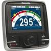
E22167 p70R Autopilot Control Head w/Rotary Knob
-
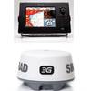
NSS8 Navigation Pack - NSS8 3G Radar
-
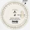
105 Marine Navigation Nautical Slide Rule
-
37637 HotMaps Platinum Multi-Dimensional 3D Lake Maps
-
RS-C208 Furuno FP Format - Barents Sea West Fishing
-
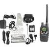
NT1VP Handheld Marine Band Radio mdlnt1vp
-
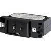
7404 20A Flat Rocker Circuit Breaker SC1
-
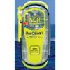
2881 ResQLink Plus PLB375
-
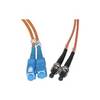
Network cable - 2 x SC MM - M - 2 x ST MM - M - Fiber optic 16.4 ft
-
lian B3-I2DN I2 System Dish Network All-in-One Package w/Multi-Sa
-
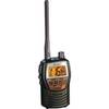
MRHH 125 Marine VHF Radio
-
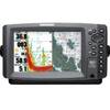
900 Series 957c Combo CHO - Marine Chartplotter - 8" color - 800 x 480 - widescreen