BlueChart g2 Vision - Bretagne - Maps
Model: Brand: Garmin
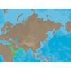
BlueChart g2 Vision offers the same rich detailed charting of BlueChart g2 to help you get the most out of your unit. In addition, g2 Vision features a growing database of high-resolution satellite imagery, above and below the water 3D perspective, auto guidance technology, aerial photographs for real world reference and coastal roads with points of interest. This product features detailed coverage from Saint-Vaast-la-Hougue to Le Croisic and Belle-Ile, including Cherbourg, the Channel Islands, Saint-Malo, Brest, and Lorient. « less
Product Specification
-
General
Product Type: MapsDistribution Media: SD Memory CardFirst Seen On Google Shopping: June 2007 -
Compatibility Information
Designed For: Garmin GPSMAP 4008, 4012, 420, 4208, 420s, 4212, 430, 430s, 430sx, 430x, 440, 440s, 440sx, 440x, 450, 5008, 5012, 520, 5208, 520s, 5212, 525, 525s, 530, 530s, 535, 535s, 540, 540s, 545, 545s, 550, 550s, 555, 555s -
Universal Product Identifiers
Part Numbers: 010-C0801-00, BretagneGTIN: 00753759069810
Related Products
-
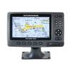
15342 Chart Master 169CS Wide Screen Chart Plotter
-
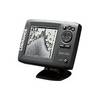
Mark 5x - Fishfinder - included transducer : Skimmer
-
PAPR03; Region 3 Paper Chart Kit
-
ME-C202 Furuno FP Format - Red Sea - Arabian Sea
-
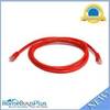
5ft 24AWG Cat6 550mhz UTP Ethernet Bare Copper Network Cable - Red
-
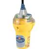
Category II Smartfind Plus EPIRB
-
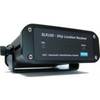
AIS Dual Channel Synthesised Rcvr SLR-200
-
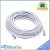
75ft 24AWG Cat6 550mhz UTP Ethernet Bare Copper Network Cable - White
-
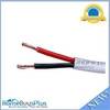
100ft 14AWG CL2 Rated 2-Conductor Loud Speaker Cable (for In-Wall Installation)
-
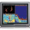
G150 Marine Display 15 Inch E62248 c31586
-
1-AR30-10-48 Air 30 Wind Generator 12VDC
-
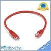
1ft 24AWG Cat5e 350MHz UTP Bare Copper Ethernet Network Cable - Red