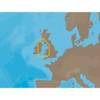
BlueChart g2 - The Nordics - Maps
Model: Brand: Garmin
BlueChart g2 features crisp labeling and an overall smoother presentation on your chartplotter display. In addition to the basic charts, tidal stations, currents, depth contours, IALA symbols and included fishing charts, BlueChart g2 offers improved transitioning between zoom levels and more seamless continuity across chart boundaries. BlueChart g2 also adds safety shading which allows the user to enable contour shading for all depth contours shallower than the user-defined safe depth. The fishing charts are designed to emphasize bathymetric contours with less visual clutter on the display. « less
Product Specification
-
General
Product Type: MapsDistribution Media: SD Memory CardFirst Seen On Google Shopping: November 2011 -
Universal Product Identifiers
Part Numbers: 010-C1021-20, The NordicsGTIN: 00753759095505
Related Products
-
SP-70R Autopilot with 18 Cu Inch Pump with Rotary Feedback for Inboard Outboard & Sterndrive c10472
-
000-10484-001 Elite-4x Sonar Transducer
-
Package(C140W, DSM300G Sounder, 4KW 18 Inch Digital Radome & Radar Cable)
-
Package(c125 with USA Coastal Chart, 4KW 18 Inch Digital Radome & Radar Cable)
-
Max EN-M300 North Sea and Denmark-MAX
-
EW-C209 Furuno FP Format - Irish Sea
-
Marine World Chart of Nicolo de Canerio Januensis 1502 Circa a Critical Study [Book]
-
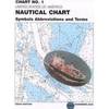
Chart No. 1 Nautical Chart Symbols Abbreviations and Terms: Spiral-Bound [Book]
-
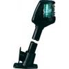
Powerboat Navigation Light, All Round Plug In, 42 Inch
-
15ft DB-25(IEEE-1284) Male to Mini/Micro Centronic 36(hpcn36) Male Cable [IE]
-
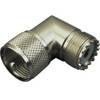
329955-1 UHF Right Angle Connector
-
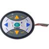
Guest Second Station Kit for 298 503 c31120