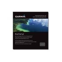
BlueChart g2 - The Netherlands (HEU018R) - Maps
Model: HEU018R Brand: Garmin
BlueChart g2 features crisp labeling and an overall smoother presentation on your chartplotter display. In addition to the basic charts, tidal stations, currents, depth contours, IALA symbols and included fishing charts, BlueChart g2 offers improved transitioning between zoom levels and more seamless continuity across chart boundaries. BlueChart g2 also adds safety shading which allows the user to enable contour shading for all depth contours shallower than the user-defined safe depth. The fishing charts are designed to emphasize bathymetric contours with less visual clutter on the display. « less
Product Specification
-
General
Product Type: MapsDistribution Media: microSD Memory CardBundled with: SD Card adapterFirst Seen On Google Shopping: December 2010 -
Universal Product Identifiers
Part Numbers: 010-C0775-20, The Netherlands (HEU018R)GTIN: 00753759091743
Related Products
-
Hi 920011 RS232 Cable for PC Connection
-
Package(e125 with USA Coastal Chart, 4KW 24 Inch Digital Radome & Radar Cable)
-
1964CBB Radar Chartplotter, Black Box, 6' Antenna & C-Map
-
BlueChart g2 Vision - Golfe Du Lion to San Remo - Maps
-
10070001 - 1420 System w/ Morse Cable Drive
-
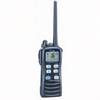
FI501 Wind Instrument Display - Head Only
-
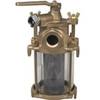
Flushing Strainer, 1 1/4 Inch
-
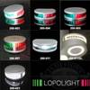
Lopo Light Masthead (3nm)
-
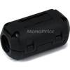
4155 Ferrite cores (1 Pair) for 24AWG HDMI Cable
-
M72 220V Charger Euro with BC-147E
-
100HM1 120/250VAC - 100 Amp Male Plug
-
B75-20-M Broadband Chirp 20 Degree Tilt, No CONNECTOR, Depth & Temperature Thru-Hull Tilted