A28 Imray Guadeloupe Marine Nautical Chart
Model: A28 Brand: Weems And Plath
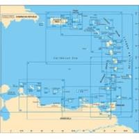
Francois and Marina de la Gde Saline Marine de Riviere Sens and Iles de la Petite Terre. The chart is flat with no folds so is suitable for framing. Size: 25 x 35-1/2 (640 x 900 cm).
Product Specification
-
Universal Product Identifiers
Part Number: A28
Related Products
-
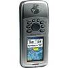
GPSMAP 76Cx - Marine, hiking GPS receiver - 2.6" color - 160 x 240
-
Package(E140W, GPS Antenna, DSM300G Sounder, 4KW 18 Inch Digital Radome & Radar Cable )
-
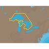
NA-C101 C-Card Format - Superior, Huron, No Chan Grgn
-
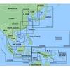
MapSource BlueChart - Hong Kong/South China Sea - Maps
-
Max EN-M326 W9 Finland Lakes-MAX
-
CF/645P+ Platinum Plus North Carolina on CF
-
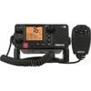
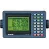
000-10213-001 RS25 VHF Radio
-
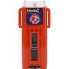
3995.4 Firefly 3 Strobe Same as 3995.3 But Bulk PK
-
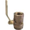
Inline Valve, 1 1/4 Inch Pipe
-
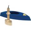
B45-DO-RCA 600W Thru-Hull Transducer RCA Connector
-
Eclipse DSC+ Fixed Mount VHF, Eclipse DSC 25W VHF Fixed White
-
GPS-90 18-Channel GPS Satellite WAAS Receiver