8267; Map-Lake Oroville/San Luis
Model: 8267 Brand: Fish-n-Map
FISH-N-MAP UNDERWATER TOPOGRAPHY MAPSMade of waterproof, tear resistant plastic. Features include: underwater depth contours, fish locations, latitude and longitude for GPS, multiple freshwater lakes on one map, boat ramps, recreational facilities and much more.
Product Specification
-
Universal Product Identifiers
Part Numbers: 082671, 234800, 432450, 8267, MSI432450GTIN: 00761428082671
Related Products
-
S100 Wireless SeaTalk Autopilot Remote Control E15024
-
500 Series 535 - Fishfinder - included transducer : XNT-9-20-T - single-beam
-
SA-M504 SD Card Format - S. America Gulf & Caribbean
-
BlueChart g2 Vision - Lake Superior - Maps
-
CF/916P-2 Platinum Plus NW Alaska & Aleutians - CF
-
6-1/4 x 4-1/2 Scoop Strainer
-
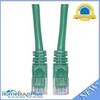
Cat6a Ethernet Cable | 5ft | Green | Network | 10 Gigabit
-
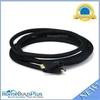
10ft 24AWG CL2 High Speed HDMI Cable w/ Net Jacket - Black
-
3964 40ft 24AWG CL2 Standard HDMI Cable - Black
-
24inch SATA 6Gbps Cable w/Locking Latch - UV Blue
-
1TWA2002 9' Air Marine Aluminum Pole Set
-
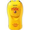
FasFind Max-G PLB w/ GPS