8264; Map-Clearlake/Lake Berryessa
Model: 8264 Brand: Fish-n-Map
FISH-N-MAP UNDERWATER TOPOGRAPHY MAPSMade of waterproof, tear resistant plastic. Features include: underwater depth contours, fish locations, latitude and longitude for GPS, multiple freshwater lakes on one map, boat ramps, recreational facilities and much more.
Product Specification
-
Universal Product Identifiers
Part Numbers: 235450, 8264, MSI432211GTIN: 00761428082640
Related Products
-
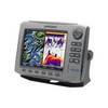
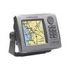
HDS-7 - Marine Chartplotter - 6.4" color - 640 x 480
-
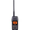
HX300 Handheld VHF Radio with USB Charger
-
FBRS 2775 Battery Serive Includes 1096 Batt Parts Labor
-
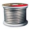
Raptor - BC4S100 - 4-Gauge Battery Cable - Silver 100' Spool
-
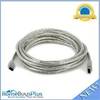
IEEE-1394 FireWire iLink DV Cable 6P-6P M/M - 15ft (Clear)
-
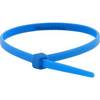
Cable Tie 4 Inch 18LBS, 100pcs/Pack - Blue
-
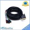
25ft DVI-I to 3 RCA Component Video Cable (DVI-I - 3-rca)
-
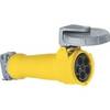
M5100C9 100A 30Y 120/208V Female Connector
-
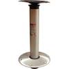
Hi-Lo 9" Fixed Height 2-3/8 Plug-in Pedestal Set - Springfield Marine
-
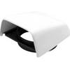
Marine Cowl Vent w/Hose Adapter f/4 BEC-C8
-
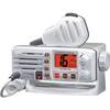
Eclipse GX1150W Class-D VHF Radio (White)
-
HDS-5 Baja - Automotive GPS receiver - 5" color - 480 x 480