4125 Map -San Diego/Ensenada
Model: 4125 Brand: Fish-n-Map
FISH-N-MAP UNDERWATER TOPOGRAPHY MAPSMade of waterproof, tear resistant plastic. Features include: underwater depth contours, fish locations, latitude and longitude for GPS, multiple freshwater lakes on one map, boat ramps, recreational facilities and much more.
Product Specification
-
Universal Product Identifiers
Part Numbers: 4125, 7101066GTIN: 00761428041258
Related Products
-
NAVPILOT 720OB Autopilot for Outboard without Pumpset
-
GPSMAP 740 GPS Chartplotter with Internal GPS Antenna 010-00835-02
-
700 Series - Transducer - included transducer : XNT-9-QB-90-T - quad-beam
-
MapSource BlueChart - Yellow Sea - Maps
-
Cd-148012 Sea Life Mini Incentive Charts
-
E70025 e165 15.4" Multifunction Display - Charts Not in
-
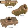
Ver. Pump Strainer f/1-1/4" Pipe 135806
-
Methods and Algorithms in Navigation: Marine Navigation and Safety of Sea Transportation [Book]
-
70 Allround Green Nav Light
-
Serial cable - (DB-9) - F - 10 ft - PC
-
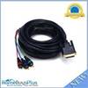
25ft DVI-I to 3 RCA Component Video Cable (DVI-I - 3-rca)
-
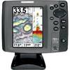
700 Series 787c2 Combo - Marine Chartplotter - 5" color - 640 x 480