010-C1025-20 Bluechart G2 HXEU718LMediterranean Sea Microsd/sd
Model: 010-C1025-20 Brand: Garmin
See your surroundings more clearly with BlueChart g2 data. With BlueChart g2, you’ll get detailed marine cartography that provides convenient viewing of nautical content. BlueChart g2 allows you to see your vessel’s precise, on-chart position in relation to naviads, coastal features, anchorages, obstructions, waterways, restricted areas and more. You will also have access to detailed mapping capabilities that include Safety Shading, Fishing Charts, smooth data transition between zoom levels, harmonious transition across chart borders, and reduction of chart discontinuities. Covers: Detailed offshore coastal coverage of the Mediterranean Sea in its entirety. Coverage features the Strait of Gibraltar, the Balearic Islands, the French Riviera, Corsica, Sardinia, Sicily, the Adriatic Sea, the Greek Islands, the Aegean Sea, the Dardanelles and Bosporus Straits, the Sea of Marmara, Cyprus, the Suez Canal, Tripoli and Algiers Harbors, and the Gulfs of Gab « less
Product Specification
-
Universal Product Identifiers
Part Numbers: 010-C1025-20, 10807295, 35822GTIN: 00753759096250
Related Products
-
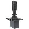
Autopilot Joy Stick E12136 c15658
-
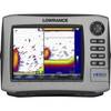
HDS-8 Insight USA Mltfnc w/o Transd 34254
-
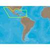
30131 Max - Central America and The Caribbean - C-Card
-
010-C0795-10 Bluechart G2 HEU451SLigurian Sea Corsica
-
86-300-001A S-4 Sart
-
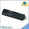
6151 USB 2.0 ATSC TV (HDTV) Tuner
-
10gb Fiber Optic Cable, LC/LC, Multi Mode, Duplex - 1 Meter
-
6ft 28AWG HDMI to M1-D (pd) Cable - Black
-
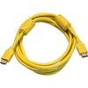
10ft 28AWG High Speed HDMI Cable w/Ferrite cores - Yellow
-
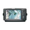
900 Series 955c - Marine Chartplotter - 8" color - 800 x 480 - widescreen
-
Marine -9-72652 PLUG,DRAIN - Magnet
-
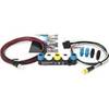
E22158 SeaTalk 1 to SeaTalk NG Converter Kit