010-C1025-10 Bluechart G2 HEU718LMediterranean Sea Data Card
Model: 010-C1025-10 Brand: Garmin
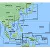
See your surroundings more clearly with BlueChart g2 data. With BlueChart g2, you'll get detailed marine cartography that provides convenient viewing of nautical content. BlueChart g2 allows you to see your vessel's precise, on-chart position in relation to naviads, coastal features, anchorages, obstructions, waterways, restricted areas and more. You will also have access to detailed mapping capabilities that include Safety Shading, Fishing Charts, smooth data transition between zoom levels, harmonious transition across chart borders, and reduction of chart discontinuities. Covers: Detailed offshore coastal coverage of the Mediterranean Sea in its entirety. Coverage features the Strait of Gibraltar, the Balearic Islands, the French Riviera, Corsica, Sardinia, Sicily, the Adriatic Sea, the Greek Islands, the Aegean Sea, the Dardanelles and Bosporus Straits, the Sea of Marmara, Cyprus, the Suez Canal, Tripoli and Algiers Harbors, and the Gulfs of Gabes and Tunisia. « less
Product Specification
-
Universal Product Identifiers
Part Numbers: 010-C1025-10, 10807287, 35821GTIN: 00753759096243
Related Products
-
MapSource BlueChart - Hong Kong/South China Sea - Maps
-
086 Chart Holder
-
SP110RF-3 System with Rudder Feedback and Type S Mechanical Das
-
Edupress EP-2520 Sea What We Can Do Incentive Chart
-
MID-NAUTICO3VP Marine Radio Nautico 3VP
-
SP36-11 SP-36 Autopilot System
-
Cockpit Scupper w/ Check Ball, Bronze
-
250ft 18AWG CL2 Rated 2-Conductor Loud Speaker Cable (for In-Wall Installation)
-
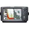
900 Series 957c Combo NVB - Marine Chartplotter - 8" color - 800 x 480 - widescreen
-
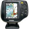
500 Series 595c Combo - Marine Chartplotter - 5" color - 240 x 320
-
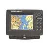
GlobalMap 7200C - Marine GPS receiver - 7" color - 640 x 480
-
Explorer Plus with GPK-10-6 GPS Antenna