010-C1020-20 Bluechart G2 HXPC024RAustralia & New Zealand
Model: 010-C1020-20 Brand: Garmin
See your surroundings more clearly with BlueChart g2 data. With BlueChart g2, you'll get detailed marine cartography that provides convenient viewing of nautical content. BlueChart g2 allows you to see your vessel's precise, on-chart position in relation to naviads, coastal features, anchorages, obstructions, waterways, restricted areas and more. You will also have access to detailed mapping capabilities that include Safety Shading, Fishing Charts, smooth data transition between zoom levels, harmonious transition across chart borders, and reduction of chart discontinuities. Covers: Detailed coverage of the entire continent of Australia and New Zealand. Coverage includes Brisbane, Sydney, and the Great Barrier Reef along the Eastern coast. Coverage continues along the Southern coast including Melbourne, Adelaide, and Tasmania through the Great Australian Bight. Coverage also includes Perth, Geraldton, Darwin, and the Gulf of Carpentaria on the Western and Northern coasts. « less
Product Specification
-
Universal Product Identifiers
Part Numbers: 010-C1020-20, 10807238, 35814GTIN: 00753759095499
Related Products
-
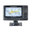
15342 Chart Master 169CS Wide Screen Chart Plotter
-
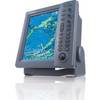
FR8062 12.1 Inch 6KW, 72 nm, 12.1 Color Display Radar without Antenna
-
BlueChart g2 Vision - Wrangell / Juneau / Sitka - Maps
-
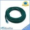
25ft 24AWG Cat6 550mhz UTP Ethernet Bare Copper Network Cable - Green
-
SP-80MT Mechanical Dash Drive w/ Built in Feedback
-
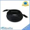
25ft 24AWG CL2 Standard HDMI Cable - Black
-
High Quality 8P8C RJ-45 Network Cable Crimper [HT-210C]
-
3ft 14AWG Power Cord Cable w/ 3 Conductor PC Power Connector Socket (C13/5-15P) - Black
-
B60-12 Tiled Element Ducer W/10P Pigtail Connector
-
CP-12L Cigarette Light Adapter for M3A/M2A c10195
-
1ft 24AWG Cat5e 350MHz UTP Bare Copper Ethernet Network Cable - Pink
-
E127 Multifunction Display w/Sonar - No Charts Map