010-C1002-20 Bluechart G2 HXEU059RGreenland East Microsd/sd ADA
Model: 010-C1002-20 Brand: Garmin
See your surroundings more clearly with BlueChart g2 data. With BlueChart g2, you’ll get detailed marine cartography that provides convenient viewing of nautical content. BlueChart g2 allows you to see your vessel’s precise, on-chart position in relation to naviads, coastal features, anchorages, obstructions, waterways, restricted areas and more. You will also have access to detailed mapping capabilities that include Safety Shading, Fishing Charts, smooth data transition between zoom levels, harmonious transition across chart borders, and reduction of chart discontinuities. Covers: Detailed coverage of the Eastern coast of Greenland from Germania Land around the southern tip of Greenland to Godthab (Nuuk) on the SW coast: Also details Jameson Land, Ammassalik, Julianehab (Qaqortoq), and Nanortalik. « less
Product Specification
-
Universal Product Identifiers
Part Numbers: 010-C1002-20, 10807212, 35804GTIN: 00753759090340
Related Products
-
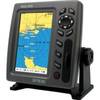
T70106 e7D 7" Multifunction Display w/Sonar, Internal G
-
EM-C104 Furuno FP Format - Aegean Sea
-
2-020 Outdoor US Rockies Chart for Endura Series
-
GPS 72H - Marine, hiking GPS receiver - Monochrome - 120 x 160
-
1032 LLB-1 Battery (1032)
-
SAS-300 Class B AIS Transceiver w/ 6.5" Tft Disp
-
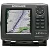
000-10520-001 HDS-5m Gen2 Nautic Insight Chartplotter
-
25ft RG6 (18AWG) 75OHM, Quad Shield, CL2 Coaxial Cable with F Type Connector - Black
-
WH10610 V-Grove Plug
-
Guest 729830-P Second Station Kit
-
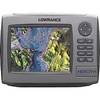
HDS-7m - Marine Chartplotter - 6.4" color - 640 x 480
-
SeaTalk Cable High Speed Network C16533