010-C0924-20 Bluechart G2 HXAW005RThe Gulf & Red Sea Microsd/sd
Model: 010-C0924-20 Brand: Garmin
HXAW005R Covers: Coverage of the Arabian Penninsula beginning at the Mediterranean Sea from Beirut to Alexandria. Coverage includes the Suez Canal, Gulf of Aqaba, and the Red Sea and Gulf of Aden in their entirety. Includes the Strait of Hormuz, Gulf of Oman, and coast of Somalia in the south. Coverage the of Kuwait, Saudi Arabia, Qatar, United Arab Emirates, along the southern coast of the Gulf and Iran along the northern coast. Coverage of Yemen and Oman coasts along the Indian Ocean to the Gulf of Oman, including Pakistan along the north coast, with general coverage of the Arabian Sea from Qamar Bay to the Delta of the Indus River. Included in this overall general coverage are numerous detailed charts covering areas such as Alexandria, Egy., Beirut, Leb., Al-Fuhaihil, Ad- Dammam, Bahrain, Ad-Dauha, and Abu Dhabi. Jiddah, Sau., Djibouti, Dji., and Aden, Yem. « less
Product Specification
-
Universal Product Identifiers
Part Numbers: 010-C0924-20, 10807154, 35798GTIN: 00753759093280
Related Products
-
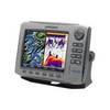
HDS-8 Insight USA w/o Ducer 140-39
-
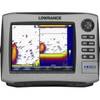
HDS-7 - Marine Chartplotter - 6.4" color - 640 x 480
-
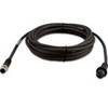
010-11419-00 - 6M Marine Heading Sensor Cable NMEA2000
-
Navigation Light BAY15d Replacement Bulb 9353384
-
5ft 24AWG Cat5e 350MHz UTP Bare Copper Ethernet Network Cable - Orange
-
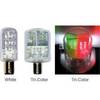
2nm Tricolor Masthead Nav LED 24V 8001436
-
USB extension cable - 4 pin USB Type A - M - 4 pin USB Type A - F - 3.3 ft - PC
-
15ft 32AWG Mini DisplayPort | Thunderbolt to VGA Cable - White
-
3939 18inch SATA 6Gbps Cable - UV Blue
-
Federal Mogul RL82C Marine Plug 874-1
-
14ft 24AWG Cat5e 350MHz UTP Ethernet Bare Copper Network 139
-
Approach S1W - Golf GPS receiver - 1" monochrome - 64 x 32