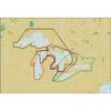
010-C0924-10 Bluechart G2 HAW005RThe Gulf & Red Sea Data Card
Model: 010-C0924-10 Brand: Garmin
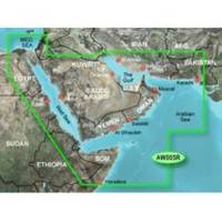
HAW005R Covers: Coverage of the Arabian Penninsula beginning at the Mediterranean Sea from Beirut to Alexandria. Coverage includes the Suez Canal, Gulf of Aqaba, and the Red Sea and Gulf of Aden in their entirety. Includes the Strait of Hormuz, Gulf of Oman, and coast of Somalia in the south. Coverage the of Kuwait, Saudi Arabia, Qatar, United Arab Emirates, along the southern coast of the Gulf and Iran along the northern coast. Coverage of Yemen and Oman coasts along the Indian Ocean to the Gulf of Oman, including Pakistan along the north coast, with general coverage of the Arabian Sea from Qamar Bay to the Delta of the Indus River. Included in this overall general coverage are numerous detailed charts covering areas such as Alexandria, Egy., Beirut, Leb., Al-Fuhaihil, Ad- Dammam, Bahrain, Ad-Dauha, and Abu Dhabi. Jiddah, Sau., Djibouti, Dji., and Aden, Yem. « less
Product Specification
-
Universal Product Identifiers
Part Numbers: 010-C0924-10, 35797GTIN: 00753759093273
Related Products
-
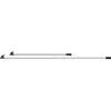
HK Tel 8ft Adjustable Boat Hooks 4132
-
Michigan, Huron, No. Chann. & Georgian Bay: NT+ Wide Coverage by C-Map
-
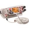
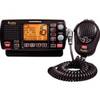
Mr F75-D Marine Class-D Digital Selective Calling Technolog
-
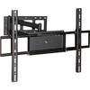
Adjustable Tilting/Swiveling Wall Mount Bracket for LCD LED
-
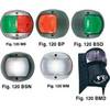
European Style Navigation Lights, Red Side Light, Black Perko
-
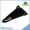
Hook & Loop Fastening Cable Ties 6inch, 100pcs/Pack - Black
-
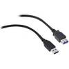
USB 3.0 | Extension Cable | 15ft | Type A | Male/Female | Black
-
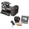
K10-00163-00 GHP 20 Marine Autopilot w/SmartPump
-
Electronics Corporation Mrf80bd New-radio Mr F80B-D Marine VHF
-
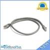
2ft 24AWG Cat6 550mhz UTP Ethernet Bare Copper Network Cable - Gray
-
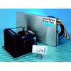
Barbour Air Cooled Power Plate PB100134
-
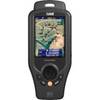
ONIX400 - Hiking GPS receiver - 3.5" color - 320 x 240