010-C0787-20 Bluechart G2 HXEU051RLista - Sognefjorden microSD
Model: 010-C0787-20 Brand: Garmin
See your surroundings more clearly with BlueChart g2 data. With BlueChart g2, you'll get detailed marine cartography that provides convenient viewing of nautical content. BlueChart g2 allows you to see your vessel's precise, on-chart position in relation to naviads, coastal features, anchorages, obstructions, waterways, restricted areas and more. You will also have access to detailed mapping capabilities that include Safety Shading, Fishing Charts, smooth data transition between zoom levels, harmonious transition across chart borders, and reduction of chart discontinuities. Covers: Detailed coverage of the Norway coast from Farsund to Sognefjorden, including the Shetland Islands. Includes detailed coverage of Bergen, Haugesund and Stavanger. « less
Product Specification
-
Universal Product Identifiers
Part Numbers: 010-C0787-20, 10805356, 35646GTIN: 00753759091965
Related Products
-
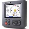
E12196 - ST70 Autopilot Control Display Only
-
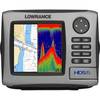
HDS-5 Nautic Insight Remanufactured No Ducer #055-0140-31
-
408470-1 581i Di Combo Fishfinder
-
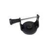
GPS receiver marine swivel mounting bracket
-
SP-80L Autopilot Designed for Outboards. Includes Pump
-
5ft 24AWG CL2 High Speed HDMI Cable w/ Net Jacket - Black
-
SmartPlug BF30 30 Amp Marine Shore Power Connector
-
LTD 50F1 50 Amp 125 Volt Female Connector
-
PT-WSBL Portable Mount Transducer Blue Connector wptwsbl
-
LTB-SS Stainless Steel Light GPS Bar
-
HS5 SeaTalk hs Network Switch, A80007 c44691
-
GP33 GPS with External Antenna and 4.3"Color Display