010-C0774-10 Bluechart G2 HEU016RMediterranean Southeast Data
Model: 010-C0774-10 Brand: Garmin
See your surroundings more clearly with BlueChart g2 data. With BlueChart g2, you'll get detailed marine cartography that provides convenient viewing of nautical content. BlueChart g2 allows you to see your vessel's precise, on-chart position in relation to naviads, coastal features, anchorages, obstructions, waterways, restricted areas and more. You will also have access to detailed mapping capabilities that include Safety Shading, Fishing Charts, smooth data transition between zoom levels, harmonious transition across chart borders, and reduction of chart discontinuities. Covers: From Gulluk, Turkey east to include Cyprus, Syria, Lebanon and Israel, then west to Misratah, Libya. « less
Product Specification
-
Universal Product Identifiers
Part Numbers: 010-C0774-10, 10805075, 35621GTIN: 00753759091712
Related Products
-
RSB0073-085 24/48 rpm Gearbox with 6.0 KW Transceiver (FR8062)
-
010-00757-00 VHF 300 AIS Marine Radio
-
Canadian Charts Sunshine Coast
-
Series 43 LED Navigation Lights, Ser 43 Black LED Nav Light Strbd
-
0348DP6PLB Thru Hull Connector 1in BRZ
-
Cat6a Ethernet Cable | 7ft | Black | Network | 10 Gigabit
-
14ft 24AWG Cat5e 350MHz UTP Bare Copper Ethernet Network Cable - Purple
-
8ft 24AWG CL2 High Speed HDMI Cable w/ Net Jacket - Black
-
Power Zone ORMAD5030Y Marine Y Adptr 50A Plg 30A CON
-
210612 16-14 Mult. Stack .250 Tab 25P
-
A62246 - Seatalk Hs Dual End Network Cable 15m
-
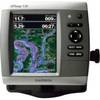
GPSMAP 536s - Marine Chartplotter - 5" color - 480 x 640