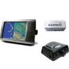
010-C0764-10 Bluechart G2 HEU005RIreland West Coast Data Card
Model: 010-C0764-10 Brand: Garmin
Detailed coverage of the west coast of Ireland from Cork Harbour to Belfast. Also covers the Scottish coast from the Isle of Colonsay to Campbeltown Harbour. See your surroundings more clearly with BlueChart g2 data. With BlueChart g2, you'll get detailed marine cartography that provides convenient viewing of nautical content. BlueChart g2 allows you to see your vessel's precise, on-chart position in relation to naviads, coastal features, anchorages, obstructions, waterways, restricted areas and more. You will also have access to detailed mapping capabilities that include Safety Shading , Fishing Charts , smooth data transition between zoom levels, harmonious transition across chart borders, and reduction of chart discontinuities. « less
Product Specification
-
Universal Product Identifiers
Part Numbers: 010-C0764-10, 10804854, 35601GTIN: 00753759091514
Related Products
-
385cxi Fishfinder GPS Combo - International Unit
-
Radar 4010 Package with GMR24HD 4KW Radome & GSD22 Sounder
-
Wpc083 Mrmk RVR to PLM Isl Snd Ed 1
-
75ft 24AWG Cat5e 350MHz UTP Bare Copper Ethernet Network Cable - Black
-
0.5ft 24AWG Cat5e 350MHz UTP Ethernet Bare Copper Network
-
75ft 24AWG Cat5e 350MHz UTP Bare Copper Ethernet Network Cable - Purple
-
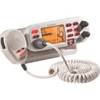
Mr F75-D Fixed Mount Class D VHF Radio - White 40521
-
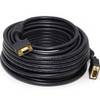
50ft Super VGA M/F CL2 Rated (for In-Wall Installation) Cable w/ Ferrites (Gold Plated)
-
M72 220V Charger Euro with BC-147E
-
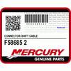
F58685-2 - Connector , NLA Mercury Marine
-
Pma6fo8l 6 Mount Wo Light Bar FFuruno
-
Matrix 12 - Fishfinder - included transducer : XNT-9-20-T - single-beam