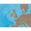
010-C0761-10 Bluechart G2 HEU002RDover to Amsterdam & England
Model: 010-C0761-10 Brand: Garmin
British coast: from Scarborough Harbour to Newhaven, including River Thames to London. Continental coast: from Amsterdam to Fecamp See your surroundings more clearly with BlueChart g2 data. With BlueChart g2, you'll get detailed marine cartography that provides convenient viewing of nautical content. BlueChart g2 allows you to see your vessel's precise, on-chart position in relation to naviads, coastal features, anchorages, obstructions, waterways, restricted areas and more. You will also have access to detailed mapping capabilities that include Safety Shading , Fishing Charts , smooth data transition between zoom levels, harmonious transition across chart borders, and reduction of chart discontinuities. « less
Product Specification
-
Universal Product Identifiers
Part Numbers: 010-C0761-10, 10804771, 35595GTIN: 00753759091453
Related Products
-
HDS-10M Insight USA Chartplotter Internal GPS 34265
-
EW-C209 C-Card Format - Irish Sea
-
RSB0073-087 24/48 rpm Gearbox with 25.0 KW Transceiver (FR8252)
-
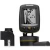
Fishin' Buddy 120 - Fishfinder - portable - included transducer - single-beam
-
CF/652P+ Platinum Plus Lake Huron on CF
-
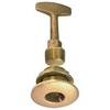
0363DP0PLB Plug Garboard Drain 3/4in
-
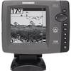
700 Series 728 - Fishfinder - included transducer : XNT-9-20-T - dual-beam
-
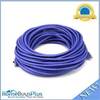
75ft 24AWG Cat5e 350MHz UTP Bare Copper Ethernet Network Cable - Purple
-
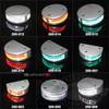
200-018 - 2*180 Degree Green - LED Navigation Light
-
16 Inch Aft Power Mount Raymarine Light Bracket Option PMA-16R-7L (PMA-167-M1 + ADA-R1)
-
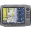
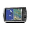
GPSMAP 4012 - Marine GPS receiver - 12.1" color - 1024 x 768
-
3ft 24AWG Cat6 550mhz UTP Ethernet Bare Copper Network Cable - Purple