010-C0760-10 Bluechart G2 HEU001REnglish Channel Data Card
Model: 010-C0760-10 Brand: Garmin
British coast: covers from Felixstowe to the Isles of Scilly, including Dover, The Solent, and the Isle of Wight. Also covers the River Thames from Twickenham to the North Sea. French coast: covers from Dunkerque to L'Aber Wrac'h, including Rouen and the Channel Islands. See your surroundings more clearly with BlueChart g2 data. With BlueChart g2, you'll get detailed marine cartography that provides convenient viewing of nautical content. BlueChart g2 allows you to see your vessel's precise, on-chart position in relation to naviads, coastal features, anchorages, obstructions, waterways, restricted areas and more. You will also have access to detailed mapping capabilities that include Safety Shading , Fishing Charts , smooth data transition between zoom levels, harmonious transition across chart borders, and reduction of chart discontinuities. « less
Product Specification
-
Universal Product Identifiers
Part Numbers: 010-C0760-10, 10804748, 35593GTIN: 00753759091439
Related Products
-
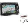
Package(e95 with USA Coastal Chart, 4KW 18 Inch Digital Radome & Radar Cable)
-
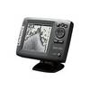
Mark 5x Portable - Fishfinder - included transducer : Skimmer
-
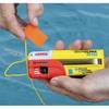
Safelink R10 SRS w/ GPS and AIS Beacon 10r10
-
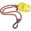
Buztronics, Inc. 1043420 Light-Saver Marine Distress LED Strobe Light
-
20ft 24AWG Cat5e 350MHz UTP Bare Copper Ethernet Network Cable - Gray
-
MMC-00821 Small Water Tight Connector
-
/ Quicksilver 22-18922 Oil Reservoir Connector
-
15.0 Beg Generator
-
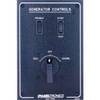
Paneltronics 9982301B Standard 120/220V AC Ship to Shore Selector
-
Inverter / Charger with Pure Sine Wave Technology
-
Cat6a Ethernet Cable | 7ft | Gray | Network | 10 Gigabit
-
3ft 24AWG Cat6 550mhz UTP Ethernet Bare Copper Network Cable - Blue