010-C0759-10 Bluechart G2 HAW451SRed Sea Data Card
Model: 010-C0759-10 Brand: Garmin
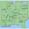
HAW451S Covers: Coverage of the Red Sea and Gulf of Aden in their entirety, as well as the Indian Ocean including portions of the coasts of Somalia and Oman. Also includes coverage of the Mediterranean Sea from Beirut, Leb. to Alexandria Egy., including the Suez Canal and Gulf of Aqaba. Included in this overall general coverage are numerous detailed charts covering areas such as Jiddah, Sau., Djibouti, Dji., and Aden, Yem. « less
Product Specification
-
Universal Product Identifiers
Part Numbers: 010-C0759-10, 10804722, 35591GTIN: 00753759091415
Related Products
-
AP35-2 Autopilot with AP35, J300X, Rudder Feedback RF300
-
LCX-113C HD - Marine Chartplotter - 10.4" color - 800 x 600
-
MapSource BlueChart - Inland Rivers - Maps
-
T70026 C95 Multifunction Display w/US Inland Charts
-
PFD 33 Gram Manual Inflatable Chest Pak in Navy Size: Small / Medium
-
POD-3S Electronic Instrument Sail Pod
-
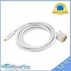
15ft 32AWG Mini DisplayPort to DVI Cable - White
-
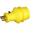
30 Amp to 15 Amp 125 Volt Hand Adapter Yellow
-
BNC-Cp/Gs-02 Connector for RG-8X Cable
-
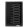
ACCY-IX Breaker Panel with Lights
-
Product Fcf0005000Gs Air Conditioner 115V FCF5000
-
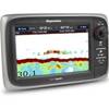
e7D 7 Multifunction W Sonar, Internal GPS - USA Silver Cha