010-C0748-10 Bluechart G2 HAF002RSouth Africa Data Card
Model: 010-C0748-10 Brand: Garmin
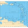
Detailed coverage of the coast of southern Africa from Namibe, Ang. to Angoche, Moz., including the South African cities of Cape Town and Port Elizabeth. Includes detailed coverage of Durban S. Af. and Maputo, Moz. Also includes detailed coverage of the Tristan da Cunha Group, the island of St. Helena, and the Prince Edward Islands. See your surroundings more clearly with BlueChart g2 data. With BlueChart g2, you'll get detailed marine cartography that provides convenient viewing of nautical content. BlueChart g2 allows you to see your vessel's precise, on-chart position in relation to naviads, coastal features, anchorages, obstructions, waterways, restricted areas and more. You will also have access to detailed mapping capabilities that include Safety Shading , Fishing Charts , smooth data transition between zoom levels, harmonious transition across chart borders, and reduction of chart discontinuities. « less
Product Specification
-
Universal Product Identifiers
Part Numbers: 010-C0748-10, 10804557, 35577GTIN: 00753759089658
Related Products
-
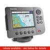
A57D Chartplotter Fishfinder No Preloaded Charts 10257368
-
D232 Imray Curacao Marine Nautical Chart
-
010-11417-00-0183 High Performance Marine Heading Sensor
-
3ft 24AWG Cat6 500mhz Crossover Ethernet Bare Copper Network Cable - Red
-
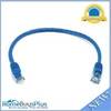
1ft 24AWG Cat5e 350MHz UTP Bare Copper Ethernet Network Cable - Blue
-
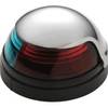
5045SS7 Stainless Steel Deck Mount Navigation Light
-
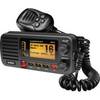
um415 Oceanus D Marine Radio (Black)
-
6ft 28AWG Dual Link DVI-D M/F Extension Cable - Black
-
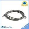
7ft 24AWG Cat6 550mhz UTP Ethernet Bare Copper Network Cable - Gray
-
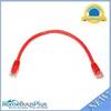
1ft 24AWG Cat6 550mhz UTP Ethernet Bare Copper Network Cable - Red
-
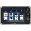
E62354 E7 7" Multifunction Display w/Internal GPS - No
-
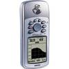
GPSMAP 76S - Marine, hiking GPS receiver - Monochrome - 240 x 180