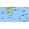
010-C0730-10 Bluechart G2 HUS029RSouthern Bahamas Data Card
Model: 010-C0730-10 Brand: Garmin
Featuring data from explorere charts for the Bahamas! Detailed coverage from Eleuthera Island, Bahamas to the Dominican Republic, including the Bahamian islands of Great Exuma, Great Inagua, Mayaguana, and many others. Also includes detailed coverage of the Jamaican, Haitian, and Dominican coasts in their entirety, the easternmost quarter of Cuba, and the Turks and Caicos Islands. See your surroundings more clearly with BlueChart g2 data. With BlueChart g2, you'll get detailed marine cartography that provides convenient viewing of nautical content. BlueChart g2 allows you to see your vessel's precise, on-chart position in relation to naviads, coastal features, anchorages, obstructions, waterways, restricted areas and more. You will also have access to detailed mapping capabilities that include Safety Shading , Fishing Charts , smooth data transition between zoom levels, harmonious transition across chart borders, and reduction of chart discontinuities. « less
Product Specification
-
Universal Product Identifiers
Part Numbers: 010-C0730-10, 10469864, 35560, GAR010C073010GTIN: 00753759089313
Related Products
-
1420 Autopilot Package with Teleflex 15 Cui Standard with Rotary Feedback 10070016 s90732
-
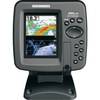
408430-1 385ci Di Combo Fishfinder
-
MapSource BlueChart - Southeast Florida - Maps
-
2846 Globalfix iPro Cat I EPIRB with GPS
-
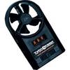
271 Wind Speed INDICATOR, FPM 0 to 8790
-
1551 Rigging Knife Deluxe
-
20ft 24AWG Cat5e 350MHz UTP Bare Copper Ethernet Network Cable - Pink
-
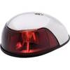
3820PF1 Light,Nav(Sold Pair Only)12Vss
-
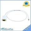
3ft 32AWG Mini DisplayPort | Thunderbolt to VGA Cable - White
-
25ft DB-25(IEEE-1284) Male to Mini/Micro Centronic 36(hpcn36) Male Cable [IE]
-
1ft 24AWG Cat6 550mhz UTP Ethernet Bare Copper Network Cable - Purple
-
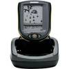
PiranhaMAX 210 Portable - Fishfinder - portable - included transducer : XNT-9-20-T - single-beam