010-C0728-10 Bluechart G2 HUS027RHawaiian Islands Mariana
Model: 010-C0728-10 Brand: Garmin
Coverage of the Pacific Ocean from the Hawaiian to Mariana Islands. Includes coverage of Guam, Midway, and Johnston Atoll. General coverage of Palmyra Atoll and the Marshall Islands also included. See your surroundings more clearly with BlueChart g2 data. With BlueChart g2, you'll get detailed marine cartography that provides convenient viewing of nautical content. BlueChart g2 allows you to see your vessel's precise, on-chart position in relation to naviads, coastal features, anchorages, obstructions, waterways, restricted areas and more. You will also have access to detailed mapping capabilities that include Safety Shading , Fishing Charts , smooth data transition between zoom levels, harmonious transition across chart borders, and reduction of chart discontinuities. « less
Product Specification
-
Universal Product Identifiers
Part Numbers: 010-C0728-10, 10469849, 35558, GAR010C072810GTIN: 00753759089290
Related Products
-
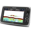
E97 Multifunction 9" Display with Sonar - US Inland Charts T70047 c44343
-
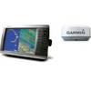
Radar 4010 Package with GMR18 4KW Radome
-
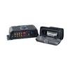
SonicHub Marine Audio Server Radio / digital player
-
Cat6a Ethernet Cable | 25ft | Green | Network | 10 Gigabit
-
3ft eSATA + USB to Esatap Cable - Black
-
Serial cable - (DB-9) - M - 15 ft - PC
-
Patch cable - CAT 5e - RJ-45 - M - Unshielded twisted pair (UTP) 25 ft - Yellow
-
24005886 Simnet Connector Protection Plug
-
DA75S - Antenna Adapter Cable, Sierra Wireless
-
3010 Thru Hull Underwater Light - Super White
-
GPSMAP 4012 - Marine GPS receiver - 12.1" color - 1024 x 768
-
1ft 24AWG Cat5e 350MHz UTP Bare Copper Ethernet Network Cable - Pink