Cartography Leader Releases Award-Winning App on Windows Store for Tablets and PCs.
Navionics, the leader in content and location based services for the recreational boating and outdoor markets, has announced its award-winning mobile app, Navionics Boating, is now downloadable on Microsoft Tablets and PCs.
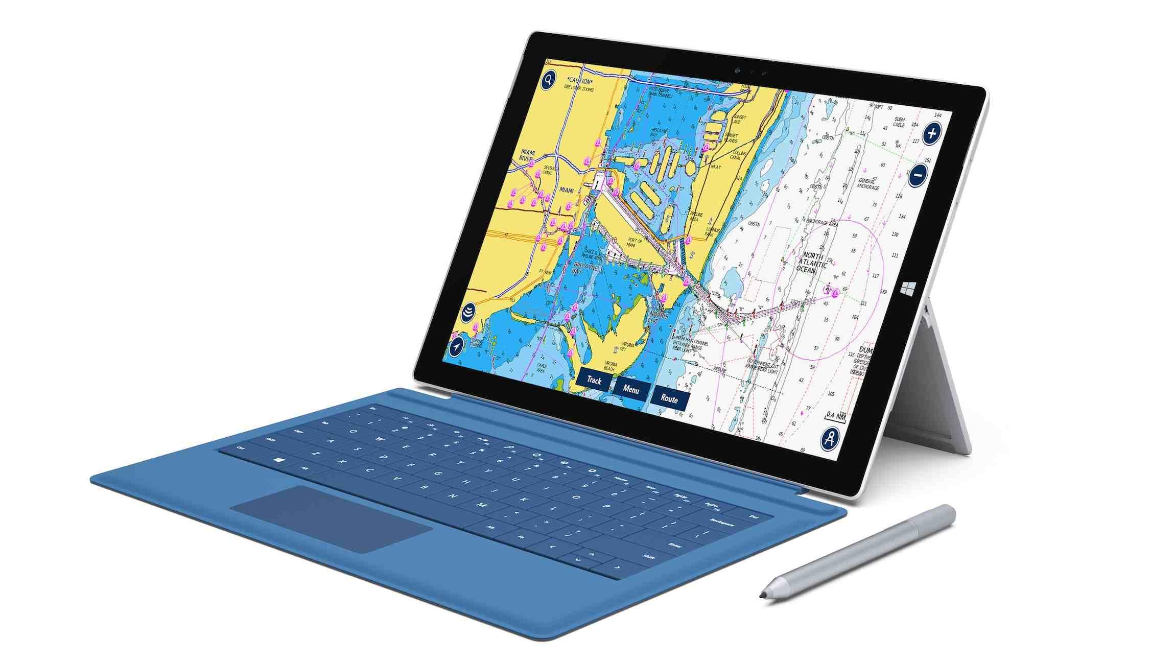
Available for free from the Windows Store for devices operating Microsoft Windows version 8.1 or higher, Navionics Boating offers the same great cartographic detail found on GPS chartplotters and is packed with functionality including navigation tracking, route planning, measuring distance and direction between points, and sharing details of a journey.
The Navionics+ ‘all-inclusive’ charting package is available for in-app purchase and includes Nautical Charts, SonarCharts and Community Edits, as well as one year of free updates. Users are able to choose any region and seamlessly merge additional coverage as needed.
Nautical Charts provide comprehensive navigation data for anywhere in the world and include navigation details such as spot soundings, port plans, navigation aids and more.
SonarCharts is a high-resolution bathymetric map for those who want more detail of what’s below the boat or by fishermen looking to maximize their productivity on the water. SonarCharts is enhanced by sonar logs contributed by boaters every day.
Community Edits are additions to charts made by Navionics users and provide useful information ranging from navigational hazards to tips for tourists.
The "Search" function (magnifying glass) provides quick and easy access to the world’s largest database of points of interest including nautical items, restaurants, marinas, to name a few. Users can also search for a specific point on the map by entering the geographical coordinates, as well as display information related to tidal fluctuations and the direction and speed of the current.
“Whether experienced or beginner, whether boater, fisherman, diver or surfer, Navionics Boating has all of the information you need,” said Giuseppe Carnevali, president of Navionics. “Now that it has been released for Windows Tablets and PCs, even more users can have access to the very best charting data anywhere in the world.”
Navionics Boating is easily found on the Windows Store, by searching ‘Navionics’. Chart coverage includes: US & Canada, USA, Caribbean & South America, Greenland & Iceland, Norway, Baltic Sea, Skagerrak & Kattegat, UK-Ireland & Holland, Central & West Europe, Mediterranean & Black Sea, Upper Volga River, Moscow Area, Lower Volga River, Central Volga River, Canaries-Azores & Madeira, Africa & Middle East, Indian Ocean & South China Sea, China Sea, Australia & New Zealand, and Pacific Islands. To download from within the app, customers can go to ‘Menu’ and then ‘Charts’.